Best Waterfalls in Armenia: Shaki, Jermuk, Trchkan & More
Armenia's waterfalls compared: Kasakh and Jermuk near 70 m, Trchkan, timetabled Shaki and three walk-in falls, plus when the water actually runs.
Armenia has one waterfall that is genuinely tall, one that is genuinely famous, and a handful worth the walk rather than the drive. The short answer: Kasakh and Jermuk are the big ones at around 70 m, Trchkan on the Shirak and Lori border is the one that actually behaves like a waterfall should, and Shaki outside Sisian is the one every southern tour bus stops at. Add Lastiver, Gegharot and the Astghik falls in Khosrov if you would rather earn the view on foot.
The catch nobody puts in the tour listing is that Armenian rivers work for a living. Two of the biggest falls here run on somebody else’s schedule: one because a hydro plant holds the valve, the other because the river upstream is emptied into the Ararat valley for irrigation. Turn up in the wrong month and you’ll drive two hours to photograph a damp cliff. So they’re ranked below by whether the trip is worth making, not by height.
Nobody agrees which one is tallest
Ask three Armenian sources and you get three different champions. The Armenian Wikipedia entry crowns Kasakh at 70 m. Armenian Geographic gives the title to Jermuk at 68 m. The national tourism board leads its round-up with Trchkan, which is 23 m.
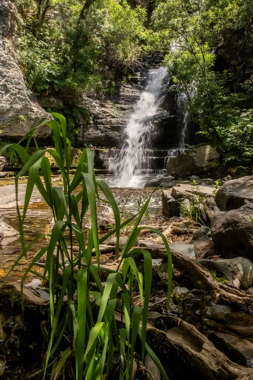
They’re all right, and the reason is a distinction most travel pages skip. Armenian Geographic labels Jermuk the highest cascade waterfall and Trchkan the highest plunge waterfall. A cascade slides down a stepped face without ever leaving the rock; a plunge quits the lip and falls through air. Jermuk comes down its 68 m in three dome-shaped terraces, which is why locals call it Mermaid’s Hair rather than anything to do with thunder. Trchkan drops clear.
So if the word waterfall makes you picture a white column with spray at the bottom, the biggest one in Armenia is 23.5 m tall. Sort this list by height and you’ll be disappointed twice over.
Kasakh: 70 m, half an hour from Yerevan, and often switched off
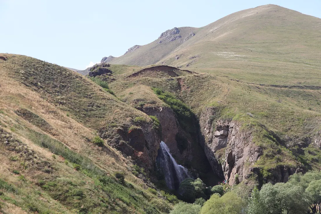
On paper this is the easy win. The Kasakh waterfall drops into the gorge at Ohanavan, directly opposite the monastery of Hovhannavank, 27 km and about 31 minutes from central Yerevan. Armenia’s tallest waterfall, basically in the suburbs.
Now the reason your guide may steer you elsewhere. The Kasagh river is held back upstream by the Aparan reservoir, built between 1962 and 1967 for one purpose: watering the Ararat valley. Spring snowmelt off Aragats fills it, summer sends that water to the fields, and Armenian river notes record the upper course of the bed as having run dry for eight months of the year. Tellingly, Kasakh does not appear at all in Armenian Geographic’s own list of the country’s waterfalls.
So treat it as a seasonal bet. Come in April or May, after the melt and before irrigation season opens, and you may get the full 70 m; come in August and you may get a wet stain on basalt. There’s no operator and no schedule to check, which is why it belongs in a half-day loop rather than a dedicated trip. The gorge, Hovhannavank and the alphabet monument at Saghmosavank are worth the morning either way.
Jermuk: the one you can reach in trainers
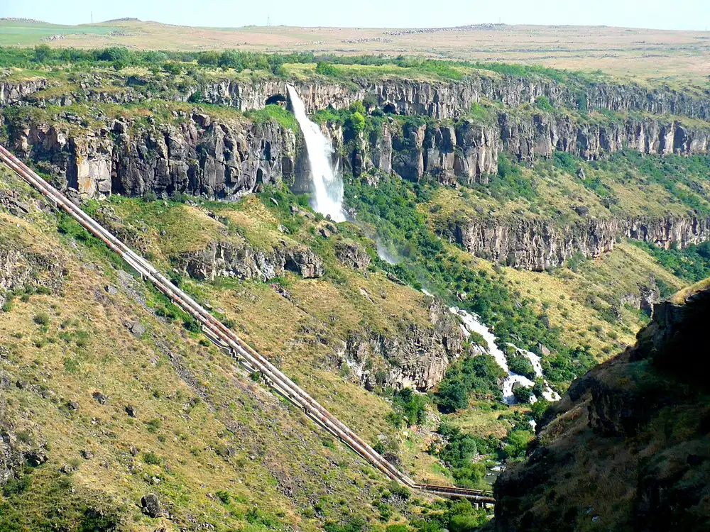
The Jermuk fall drops 68 m into the Arpa over three dome-shaped terraces and is protected as a hydrogeological natural monument. Most English-language pages round the figure up to 70 m, so don’t be thrown by seeing both.
Two things make it the most dependable of the big ones. It’s fed by springs rather than by a dammed snowmelt river, so no reservoir gate governs it. And the access is absurdly easy for something this size: a short path from the car park below the road bridge reaches a viewing point in about five minutes, while the walk from town takes around half an hour on an easy, if rocky, path with steps. The water is bitterly cold in any month.
Jermuk is 171 km and roughly 2 h 40 southeast of Yerevan, a stretch as a day trip and a natural overnight. The spa town is the real draw: see our guide to Jermuk, the buses and shared taxis in getting from Yerevan to Jermuk, and the sanatoriums in where to stay in Jermuk.
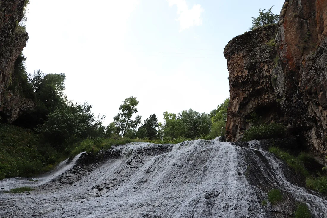
Trchkan: the one they refused to pipe
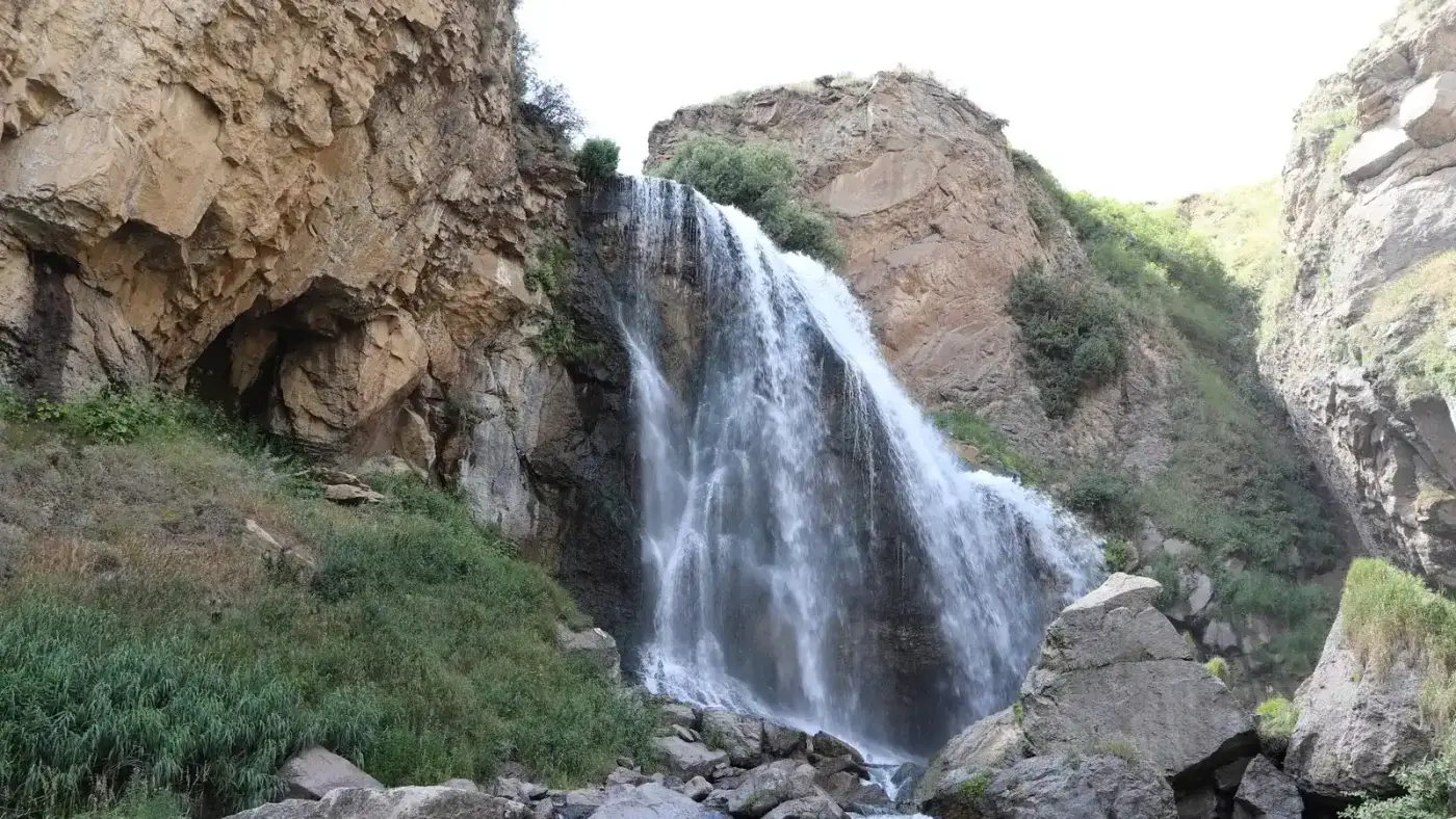
Trchkan is 23.5 m on the Chichkhan, a left feeder of the Pambak that runs down the border between Shirak and Lori near the villages of Shirakamut and Mets Parni. The name means jumping, after the trout that hurl themselves at the falls in spawning season; HikeArmenia calls the path to it the Trout Jump Trail.
It’s also the one Armenian waterfall with a rescue story. In April 2010 a company called Robshin Ltd was licensed to build a small hydro plant on the Chichkhan. Protests began that September, activists camped at the falls from 25 October to 7 November 2011, the company stopped construction on 31 October, and on 3 November 2011 the government killed the project and granted the falls protected status. That history is why Trchkan is dependable in a way Kasakh is not: nobody upstream decides when to open a valve, and the state’s own measurement during the argument put the flow at 400 to 500 litres per second.
Getting there takes commitment. Yerevan to Shirakamut is 109 km and about 1 h 50, and the last stretch is a rough track where a high-clearance car earns its keep; the tourism board’s own phrasing is an off-road drive or roughly a half-hour walk from the village. The alternative is the marked trail from Sarapat in Shirak: 7.1 km one way, rated easy, about two hours each way alongside the river. That’s a 14 km round trip, so budget half a day.
From up north it barely counts as a detour: 31 km from Vanadzor, and Sarapat is 31 km from Gyumri. One traveller reported taxi-app quotes in mid-2025 of 11,500 AMD from Yerevan (around $31), 4,700 from Vanadzor and 4,000 from Gyumri, which is a single data point rather than a tariff. There are picnic grills at the falls, the site freezes solid in winter, and Shirakamut was the epicentre of the 1988 earthquake. Pair the falls with Gyumri or the monasteries of Lori and you have a proper northern day.
Shaki: the famous one that keeps office hours
Shaki spreads 18 m across a basalt ledge outside Sisian, minutes off the M2, and it’s the waterfall Armenian tourism puts on posters. It’s also the clearest case of a river on a timetable: a hydro plant takes the water above the drop, and a ministerial order sends it back down the cliff only between fixed hours, 11:00 to 19:00 from May to September and 11:00 to 17:00 in spring and autumn. Turn up at nine and there’s nothing to see.
Because the clock rules the visit, it gets its own page: read Shaki waterfall before you plan the drive, and slot it into our three-day southern road trip rather than driving 430 km round trip for it.
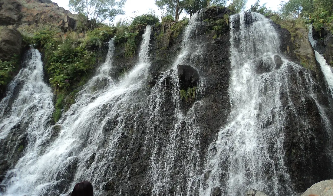
Three for people who want to walk
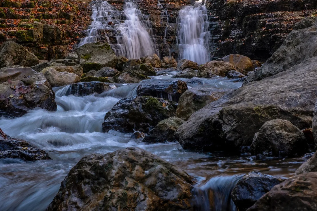
Lastiver, Tavush
The Khachaghbyur river drops through a forest gorge below Yenokavan, 141 km and 2 h 15 north of Yerevan. The Tavush tourism agency puts the falls 3 km from Lastiver village and 6 km from Yenokavan, reachable on foot, by off-road vehicle or on horseback; the tourism board describes the walk in as about 40 minutes on ground that is steep and muddy.
Set expectations honestly. No source gives Lastiver a height, because it’s a stepped run of small drops rather than one big fall. What sells the place is the gorge, the cliff caves that sheltered villagers in the Middle Ages, and the tree houses you can sleep in. Most people combine it with the ziplines at Yell Extreme Park above the same canyon, or with nights in Dilijan.
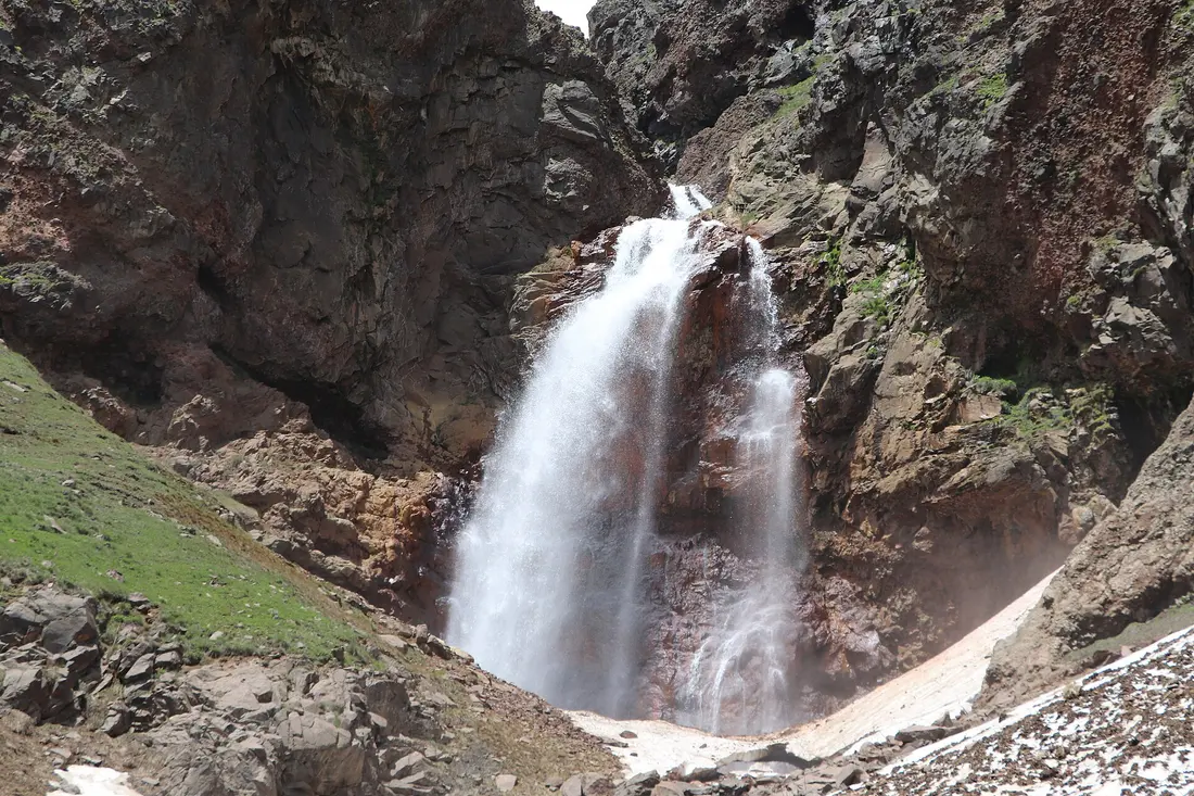
Gegharot, Mount Aragats
17 m of very cold water at roughly 3,000 m on the flank of Aragats, listed as a natural water monument and frozen solid for much of the winter. It’s about 12 km from Aragats village, itself only 46 km and 51 minutes from Yerevan, but that last stretch is either an hour of four-wheel driving up the Gegharot gorge or a walk of about 10 km each way. Treat it as a hike with a waterfall at the end, not a viewpoint.
Here’s the detail that makes the geography click. Gegharot sits on a tributary of the same Kasagh river that produces the 70 m fall at Ohanavan: top of the system and bottom of it, with the Aparan reservoir in between deciding how much water reaches the gorge. Our guides to Mount Aragats and Lake Kari and hiking in Armenia cover what these altitudes ask of you.
Astghik and Vahagn, Khosrov reserve
Four waterfalls in the Khosrov Forest State Reserve go collectively by the name Aghjots, and two carry the names of the pagan goddess of love and the god of fire. The classic approach starts at Garni, 50 km from Yerevan, and runs up the Azat gorge past an 11th-century bridge; Armenian Geographic puts the full route at 18 km, moderate, walkable in any season.
One warning worth taking seriously. Khosrov is a strict state reserve, so entry is ticketed and you’ll normally be expected to take a guide. Figures on operator pages run from 2,000 to 10,000 AMD depending on citizenship and whether a guide is included, and no official price list is published anywhere I could reach, so confirm at the reserve’s visitor centre in the Garni district first. Pairing it with Garni temple and Geghard monastery is the sensible way to use the drive.
When the water runs
Everything above runs on snowmelt: the strongest flow arrives between late March and June and thins through the summer. For scale, the official natural monument passport for Shaki records its river at 2.57 cubic metres per second in May against 0.57 by December. A fivefold swing on one river, and the same curve applies to the rest.
- April and May. Peak water, and the reason to come. The trade-off’s altitude: Gegharot at 3,000 m is still under snow and mountain tracks are at their worst.
- June to September. Everything’s reachable and the walks are pleasant. Flow is falling, and Kasakh is the first to disappear.
- October. Weakest water, best colour, especially in the Tavush and Lori forests. Our guide to Armenia in October has the autumn timing.
- Winter. Trchkan and Gegharot freeze, which is a genuine sight if you can get to them. Shaki’s schedule lapses entirely between 16 November and 14 March.
For the wider seasonal picture, see the best time to visit Armenia.
So which one do you actually drive to
Half a day out of Yerevan, in spring: Kasakh, inside the Hovhannavank and Saghmosavank loop so the morning still works if the river is low.
Already heading south: Shaki, thirty or forty minutes, timed to the release window.
Surest water, comfortable base: Jermuk. It’s the only big fall with a town, a bed and a mineral-water gallery attached.
The real thing, and you have a day: Trchkan, out of Vanadzor or Gyumri rather than Yerevan.
Forest rather than gorge: Lastiver, with the ziplines or the tree houses to justify the drive.
One to skip unless you’re already there: the Lichk and Heart falls near Meghri. They sit inside the Arevik National Park, need advance registration and a permit reported at 1,000 AMD for residents and 2,000 for foreigners, and Meghri is 366 km from Yerevan.
Four of the seven need a car, and two of those want clearance. Car rental in Armenia covers what these roads ask of a hire car, and the best day trips from Yerevan puts the closer falls alongside everything else within an hour of the capital.
Read also

What to see · 10 min read
Soviet Modernist Yerevan: An Architecture Walk
Verified · September 5, 2026Walk Yerevan's Soviet modernism: Rossiya Cinema, Komitas Hall, Cascade, Hrazdan Stadium and Demirchyan Complex - dates, route order, and what still stands.

What to see · 9 min read
Kond: Walking Yerevan's Oldest Neighborhood
Verified · September 3, 2026Walk Kond, Yerevan's oldest living quarter: Surp Hovhannes, Tepebashi mosque walls, Leo Street alleys, and how to visit without treating it like a set.
What to see · 8 min read
Sardarapat Memorial: Armenia's 1918 Battle Site
Verified · August 31, 2026Sardarapat Memorial near Armavir: 1918 battle site, Israelyan's red-tufa complex, ethnography museum tickets, hours and how to reach it from Yerevan.
What to see · 12 min read
Goshavank Monastery & the Village of Gosh
Verified · August 29, 2026Visiting Goshavank: Mkhitar Gosh's law code that reached Poland, the 1291 embroidered khachkar, his statue and hillside tomb, and the drive from Dilijan.