Debed Canyon Road Trip: Monasteries of the North
Two days from Yerevan: the M3 to Aparan and Vanadzor, then the M6 down the Debed to Dsegh, Kobayr, Sanahin, Haghpat and the frescoes of Akhtala.
You’ll want two days for the Debed. Out and back from Yerevan it runs roughly 390 km: north on the M3 over the Pambak range through Aparan and Vanadzor, then down the M6 into the gorge, where Sanahin and Haghpat share a single UNESCO listing, Kobayr hangs off a ledge above the river and Akhtala hides a 13th-century painted church inside a fortress. One night in the canyon splits the driving unevenly: about three hours on day one, closer to four and a half on day two, because the run home from Akhtala swallows three and a half of them on its own.
The usual alternative is one very long day out of the capital. Yerevan to Haghpat is 172 km and about three and a half hours each way, so seven hours of it goes on driving: leave at eight, arrive with the coaches around midday, turn for home by four. Two days buys back what that cuts: Kobayr, reachable only on foot; Akhtala, which almost no group tour bothers with; both UNESCO monasteries in early or late light. One rule keeps it simple: stay on the M3 and the M6, because Armenia’s eastern border districts carry a travel advisory and there’s no sense improvising a shortcut.
How the two days split
The break falls where the road drops off the Pambak plateau into the gorge: highway first, monasteries second.
- Day 1 (Yerevan to the canyon, about 150 km, under three hours driving): the M3 north with a bread stop in Aparan, lunch in Vanadzor, then the M6 and the climb to Dsegh. Sleep at Dzoraget or Alaverdi.
- Day 2 (Kobayr to Akhtala, 47 km of short hops, then 180 km home): Kobayr on foot first thing, Sanahin and Haghpat at midday, Akhtala last, then three and a half hours back down the M6 and M3. Four and a half hours at the wheel, most of it after the sightseeing ends.
Day one: north over the pass to Aparan and Vanadzor
The first hour is dull in the best way: flat, fast and straight through Ashtarak. Then the M3 turns into the Kasagh valley and starts climbing, with the Aparan reservoir a couple of kilometres off to the right, until you reach Aparan at 1,880 m, a plain highland town of about 5,800 people that travellers know for exactly one thing.
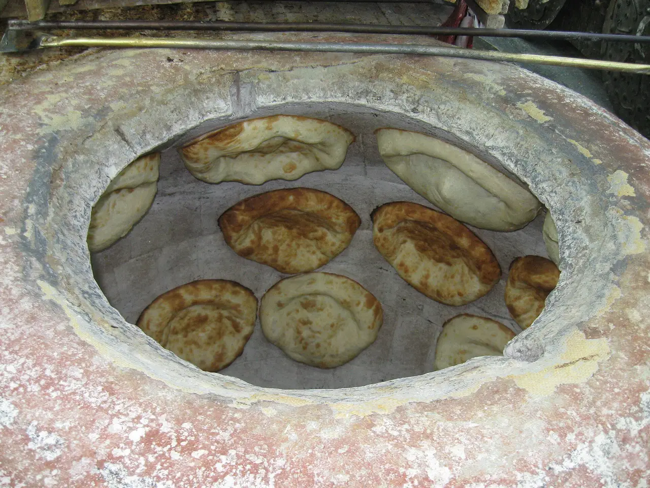
That thing is Gntunik, a bakery and supermarket on the main street where bread is slapped onto the wall of a tonir and comes out blistered and too hot to hold. Gata, lavash, khachapuri, baked potatoes, and a proper shop with toilets around the ovens. Nobody publishes opening hours, so don’t treat it as a timed stop - buy more than you think you need in daylight.
North of Aparan the road tops out at around 2,150 m on the Pambak range, and the far side changes at once: bare highland gives way to wet green hills. You come down through Spitak, rebuilt slightly to one side of where the 1988 earthquake flattened it, and into Vanadzor, Armenia’s third city and the capital of Lori, about 75,000 people in a broad wooded valley. Not a sight, but the last proper town before the canyon: eat, fill up and draw cash, because nothing else on the route comes near its size.
Into the gorge: Dsegh and the poet
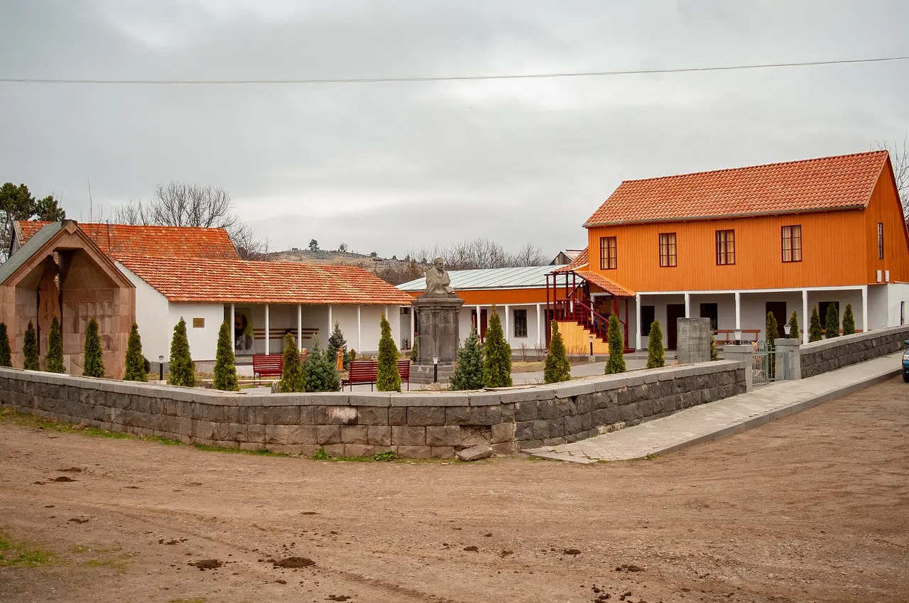
Out of Vanadzor the M6 follows the water down, and near Dzoragyugh the Dzoraget and the Pambak meet to become the Debed, a river that runs 176 km before crossing into Georgia. The canyon closes in fast. Thirty-one km on, a side road climbs onto a wooded shelf above the right bank to Dsegh, 13 km south of Alaverdi, with two churches from the 7th and 8th centuries and a khachkar cemetery.
Dsegh is where Hovhannes Tumanyan was born in 1869, and his house-museum is the one stop with hours you have to plan around: Tuesday to Sunday 10:00 to 18:00, Sundays only 11:00 to 16:00, closed Monday. Tickets are 1,000 AMD, half that for students and pensioners, free under 12; a tour in a foreign language is 3,000 AMD, and the museum asks you to call ahead. Behind the house is a chapel in the garden where the poet’s heart is buried. If your two days fall on a Sunday and Monday, put Dsegh on day one and get there before four.
Day two: the climb to Kobayr
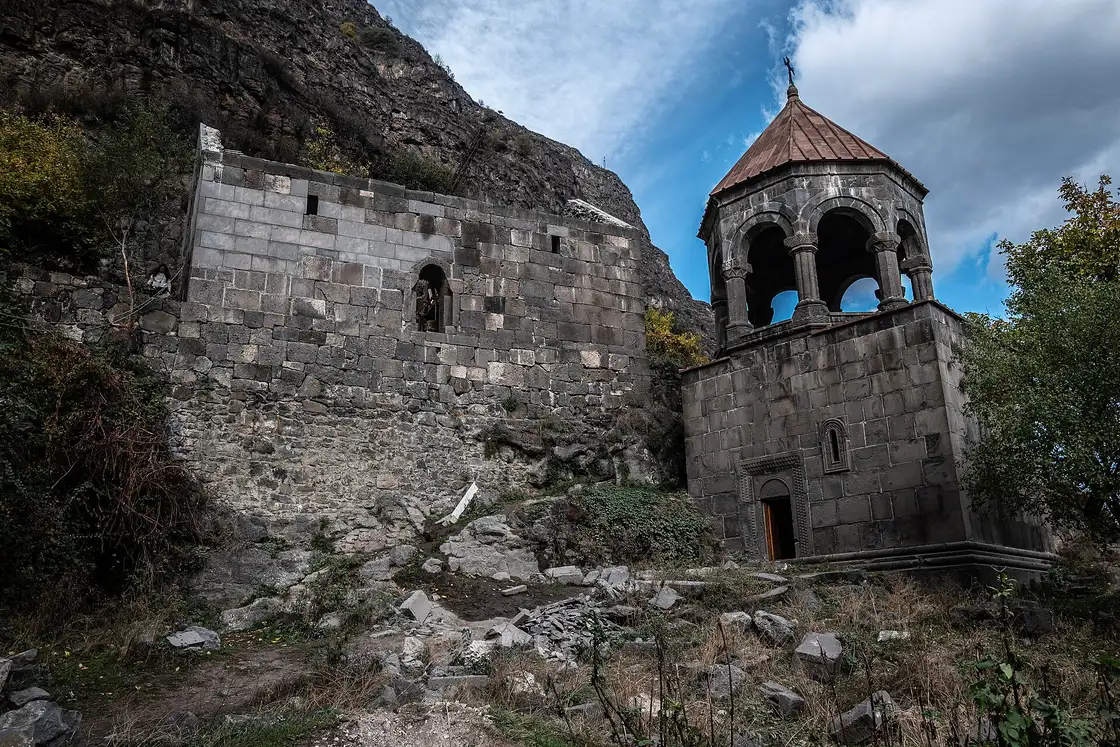
Start early, because Kobayr catches people out. There’s no car park and no road to it: the monastery sits on a ledge in the canyon wall above the town of Tumanyan, and you walk up from the M6 through the hamlet of Kober. Three paths climb it: the steepest from below the ruins by the little railway halt, a gentler signed one about a kilometre south, and a third between them. Allow an hour for the round trip and wear shoes with grip, because the way down runs through terraced gardens on loose ground.
Kobayr went up in 1171 under the Kyurikid princes, passed to the Zakarians in the 13th century and became a Chalcedonian house, which is why Georgian inscriptions stand on the walls beside the Armenian ones, a genuine oddity here. The bell tower of 1279 holds the tombs of Shanshe Zakarian and his wife Vaneni, and the ruined church still carries frescoes of Christ, the apostles and the Church Fathers. As of 2026 it’s under restoration, Armenian state money with Italian help, so expect scaffolding in your photographs.
Sanahin and Haghpat: one listing, two hilltops
These two are why the region is on anyone’s map. UNESCO inscribed Haghpat in 1996 and added Sanahin in 2000, as the “Monasteries of Haghpat and Sanahin”: Kiurikian-era centres of learning, listed for a style that fused Byzantine church building with Caucasian stonework.
Here’s the part that ruins timetables. On the map the two sit barely 3 km apart, with a footpath between them; by road it’s 16 km and about twenty minutes, because the only link drops into Alaverdi and climbs the far side. Use the descent: the medieval single-span stone bridge over the Debed in Alaverdi belongs to the same UNESCO inscription and has carried no cars since the 1960s. Nothing there announces it, so people cross a piece of World Heritage on the way to the shops.
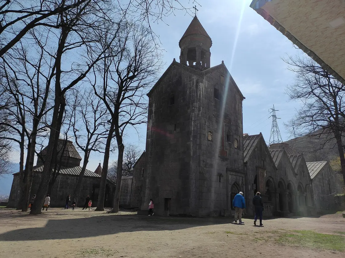
Sanahin is the scholarly one. Its name is usually translated as “this one is older than that one”, a dig at its neighbour; UNESCO dates its St Astvatsatsin church to 928-944 and St Amenaprkich to 957-966, built under Queen Khosrovanush. It ran a famous school of illuminators and calligraphers, and its arcaded academy gallery is still there to walk through. A few hundred metres away is the museum of the Mikoyan brothers, Anastas the Soviet politician and Artem of MiG fame, both born here, with a real MiG-21 parked outside under a concrete wing. Published hours for it contradict each other, so ask on the spot.
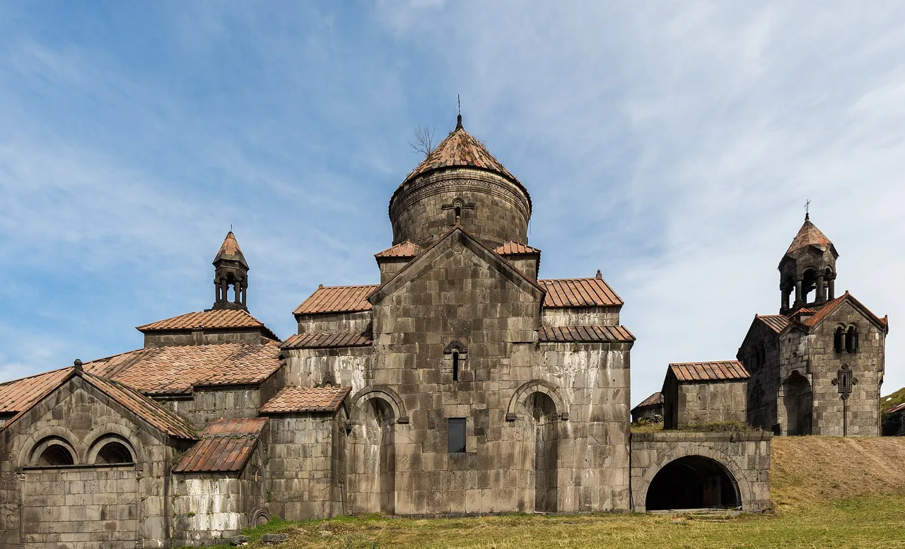
Haghpat, up the other side, is the grander one: founded in 976 by Queen Khosrovanush, St Nshan church finished in 991, a free-standing three-storey bell tower of 1245, Abbot Hamazasp’s hall of 1257 and the Amenaprkich khachkar of 1273 by the north door. It stands on a shelf of green with mountains stacked behind and the canyon dropping away in front.
Neither monastery has a ticket office, a turnstile or published hours. They’re working churches: free to walk into, contributions welcome, sensible between mid-morning and sundown. Dress modestly, and keep quiet if a service is under way.
Akhtala, and the frescoes nobody queues for
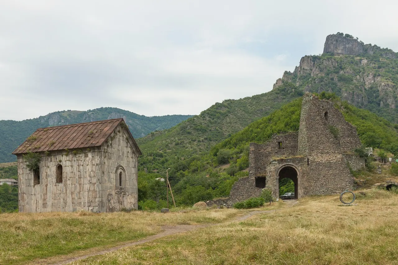
Fourteen kilometres north of Haghpat, 185 km out from Yerevan, the road reaches a copper-mining town and a spur of rock carrying a fortress gate, a 13th-century tower and a church. This is Akhtala, once Pghindzavank, the “copper mine monastery”, with some of the best-preserved fortress walls in Armenia.
The frescoes are indoors and they’re the whole point. Surb Astvatsatsin was painted for the Zakarid ruler Ivane I Zakarian between 1205 and 1216, Armenian-Chalcedonian in style, with inscriptions in Armenian, Greek and Georgian across walls, partitions and piers. There’s no fee and no guarantee the door will be open: the key is often kept by someone in the village, so ask around.
The road, the car and the fuel
Marshrutkas run town to town along the valley floor. Every stop on this list sits above it, up a spur of five to twenty minutes that no minibus serves, which is the case for renting in Yerevan rather than negotiating a taxi in Alaverdi each morning.
The M3 to Vanadzor is easy going: two lanes, decent surface, one long pull over the Pambak where a small engine makes itself heard. The M6 below it has a history. It covers 90 km to the Georgian border at Bagratashen, and 51.5 km of that was rebuilt under an Asian Development Bank loan approved in 2016. Drivers in 2019 described a building site; by 2024 the reports had turned, the climb to Sanahin included. Roadworks still come and go, so trust a recent review over an old one.
Two things to settle before you leave. Fuel: close to 400 km with two climbs in it, so start full and top up in Vanadzor. Car: a small one is enough outside winter, since the M3 and M6 are paved end to end and the spur to Sanahin was resurfaced with the rest. For what an agency holds on your card and what the excess leaves you liable for, see renting a car in Armenia; for how traffic behaves off the highway, driving in Armenia. If you’re not driving, getting around Armenia is honest about how far marshrutkas reach, which isn’t far enough here.
Where to sleep in the canyon
Sleep in the canyon rather than in Vanadzor and Kobayr lands inside breakfast range: ten minutes from Dzoraget, a little over twenty from Alaverdi. The best-known address is the Tufenkian Avan Dzoraget, built like a small fortress on the river, with a spa. Check the distances before you book it for the location: Haghpat is 35 minutes away by road, double the straight line, because the canyon makes you drop to the river and climb out again. Cheaper beds are in Alaverdi and the villages of Haghpat and Sanahin, where the guesthouse is the norm.
Two people sharing a small rental car, one mid-range room, fuel, the Dsegh ticket and food land near 60,000 AMD a head over two days. That’s arithmetic, not a price list: nobody publishes a rate for a village guesthouse in Haghpat, and the car and the fuel are the lines that move it.
Season, and what to drop when the day slips
May to October is the working window, and high summer has a real argument behind it. On the 1991-2020 normals Vanadzor averages a July high of 25.7 C at 1,350 m against 34.5 C in Yerevan: nine degrees, which is reason enough to point the car north in July. The Kobayr path wants dry ground, and the small roads turn slick as soon as the weather does.
Days slip, so decide the order of sacrifice in advance. Akhtala goes first: it’s furthest north, and the church door may be locked anyway. Dsegh goes if you’ve landed on a Monday, when the museum shuts, or after four on a Sunday. Kobayr never goes, because it’s the one stop no coach can do at all.
With a third day, Gyumri sits about 63 km west of Vanadzor and Yerevan to Gyumri covers the train if you’d rather loop home that way; Dilijan is the green counterpart an hour east; and carrying on north, the Bagratashen crossing used by the Yerevan to Tbilisi run is 30 km on. For Lori beyond this drive, Odzun and Lori Berd included, read northern Armenia, Lori, Haghpat and Sanahin; the 7-day Armenia itinerary places a northern leg in a longer trip.
Two decisions carry the whole thing: sleeping in the canyon instead of driving back, and standing at the bottom of the Kobayr path by nine in the morning. Get those right and the road handles the rest.
Route day by day
- Days on the road
- 2
- Distance
- ≈390 km
- Budget from
- 60000 AMD
- Best season
- May, June, July, August, September, October
-
Yerevan
Route startstop ≈0 min
Start point. Fuel up and head north on the M3 through Ashtarak. Leave by eight and you are at the bakery in Aparan before the coaches, an hour up the road.
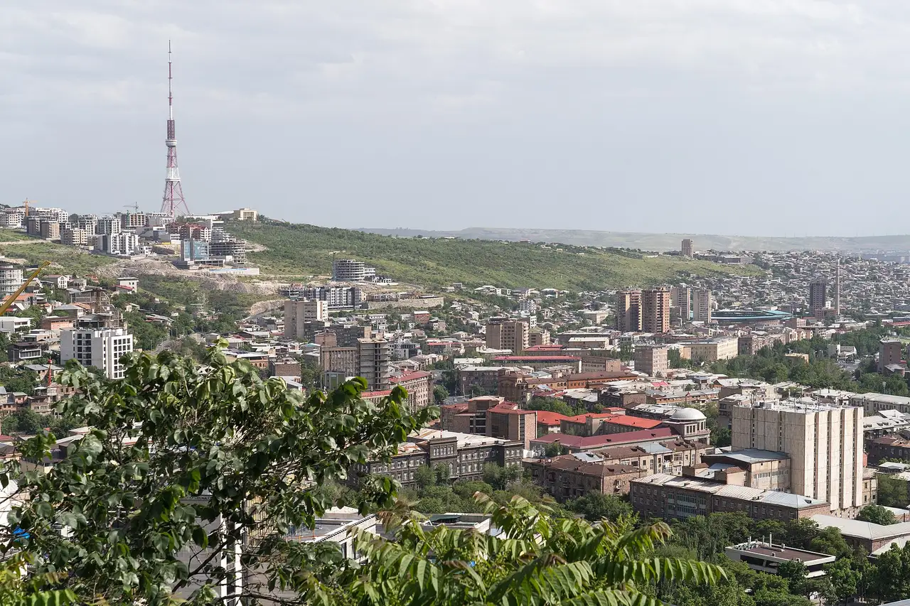
Photo: Alexkom000 / Wikimedia Commons, CC BY 4.0 ( source) -
Aparan (Gntunik bakery)
55 km from the startstop ≈30 min
A highland town at 1,880 m on the Kasagh, and the standard breakfast stop on the north road. Gntunik bakes into a tonir on the main street: bread, gata, lavash. No published hours, so treat it as a daylight stop.
Photo: Valen1988 / Wikimedia Commons, CC BY-SA 4.0 ( source) -
Vanadzor
117 km from the startstop ≈45 min
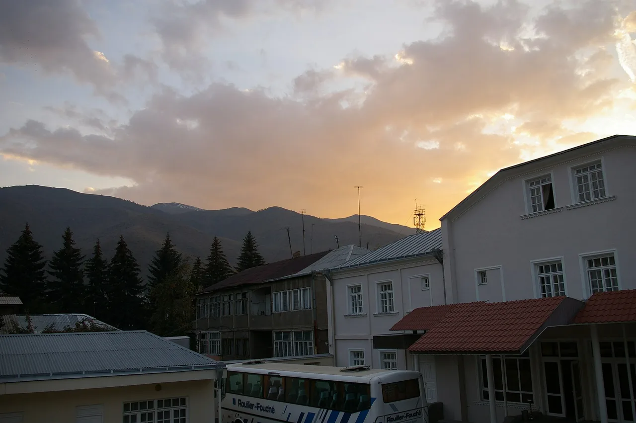
The third city of Armenia and the capital of Lori, population about 75,000. Lunch, cash and fuel before the canyon. The M6 to the Georgian border starts here.
Photo: Deb Collins / Wikimedia Commons, CC BY 2.0 ( source) -
Dsegh
148 km from the startstop ≈90 min
The poet Hovhannes Tumanyan was born here in 1869. His house-museum opens Tue-Sun 10:00-18:00, Sundays 11:00-16:00, closed Monday; 1,000 AMD, tours in a foreign language 3,000 AMD, phone ahead.
Photo: Harut Chatinyan / Wikimedia Commons, CC BY-SA 4.0 ( source) -
Kobayr
164 km from the startstop ≈75 min
Built in 1171 and half fallen off its ledge above Tumanyan. Reached on foot only: three paths climb from the M6, the gentlest signed about a kilometre south of the monastery. Under restoration as of 2026.
Photo: Vladimir Pankratov / Wikimedia Commons, CC BY-SA 4.0 ( source) -
Sanahin
182 km from the startstop ≈75 min
The scholarly half of the UNESCO pair, with a school of illuminators and an academy gallery you can still walk. St Astvatsatsin church dates from 928-944. Free, no ticket office.
Photo: Soghomon Matevosyan / Wikimedia Commons, CC BY-SA 4.0 ( source) -
Haghpat
197 km from the startstop ≈90 min
Founded in 976 by Queen Khosrovanush. St Nshan church was finished in 991, the free-standing bell tower went up in 1245, and the Amenaprkich khachkar is dated 1273. Free.
Photo: Poco a poco / Wikimedia Commons, CC BY-SA 4.0 ( source) -
Akhtala
211 km from the startstop ≈60 min
The last stop, 185 km from Yerevan. A fortress gate, a 13th-century tower and a church painted for Ivane Zakarian between 1205 and 1216. The interior is sometimes locked and the key is held in the village.
Photo: Marcin Konsek / Wikimedia Commons, CC BY-SA 4.0 ( source)
Route map
The map with stops loads on click - to keep the page lightweight.
The map didn’t load. Check your connection and refresh the page.