Lake Sevan Grand Loop: Around Armenia's Biggest Lake
A 1-2 day self-drive loop around Lake Sevan: Sevanavank, Hayravank, the Noratus khachkars, Gavar, Martuni and the Selim pass caravanserai.
Most visitors treat Lake Sevan as a photo stop: drive up from Yerevan, climb the steps at Sevanavank, look at the blue water for twenty minutes, and drive back. That works, but it misses the point of the place. Sevan is the largest lake in the whole Caucasus, a 74 km sheet of water sitting at 1,900 m, and its shore strings together some of the most rewarding sights in the country. Give it a car and a day or two and you can circle it properly, from the peninsula monastery to the biggest field of carved cross-stones on earth, and finish over a 2,410 m mountain pass. This is how to drive that loop, and how to shape it around the weather and your time.
Here’s the trick that makes it a loop and not an out-and-back. You run northeast up to the lake, follow the west and south shores past the monasteries and the khachkars, then instead of turning around you keep climbing over the Selim pass into the next province and come home through Vayots Dzor on the M2. No backtracking, a completely different landscape on the way out and the way back, and a real sense of having gone somewhere. It’s about 340 km all told, which is a long but doable single day, or a relaxed two-day trip with a night on the lake or in Gavar.
A word on how to travel it. This is a self-drive route. The town of Sevan and Sevanavank are easy enough by marshrutka, but Hayravank, Noratus, Gavar, Martuni and above all the Selim pass are strung out on their own quiet roads, and stitching them together on public transport means half your day at the roadside. Don’t plan this loop on buses alone. Roads are paved and in decent shape the whole way; the only real variable is the pass. Because the Selim pass is the spine of the loop, treat this as a June to September trip. The pass usually opens around May and can stay clear into November, but snow closes it for much of the year and can catch you out in the shoulder seasons. Sevan itself is high, so even in August pack a layer: the lake is cooler and windier than the city baking down in the valley.
Sevanavank: the peninsula monastery
Point the car northeast out of Yerevan on the M4 and in about an hour you crest the last rise and the lake opens out below you, which never quite loses its effect. The first stop is Sevanavank, the pair of dark tuff churches on the peninsula at the northwest corner. They were founded in 874 by Princess Mariam, a daughter of King Ashot I, and the two that still stand, Surb Astvatsatsin and Surb Arakelots, are small, severe and beautifully sited. A stone staircase of roughly 230 steps climbs to them, and the reward at the top is the view rather than the interiors: you’ll see the whole basin of the lake laid out, boats and swimmers below, the far shore a thin line of mountains.
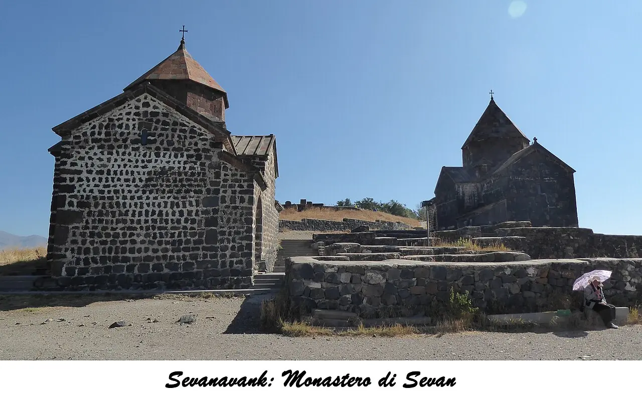
The peninsula is worth a second’s thought, because it explains a lot about Sevan. The monastery was built on an island. In the Stalin years the lake was tapped for irrigation and power and the level fell about 20 m, and the island became the headland you now walk up. That drop reshaped the whole shoreline, which is why so many of the sights below sit slightly back from the water. For the full story of the lake, the beaches and the fish, our guide to Lake Sevan goes deeper, and there’s a dedicated write-up of Sevanavank monastery if you want the history before you climb. If you’d rather come up by bus than drive, the practicalities are in getting from Yerevan to Lake Sevan.
Hayravank: the quiet one on the water
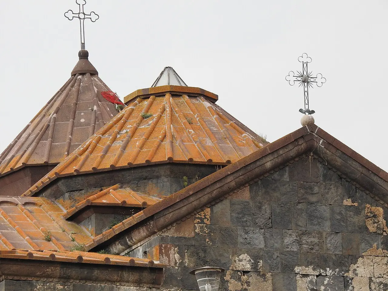
From Sevanavank, follow the western shore south. About 35 km on, a small sign points down to Hayravank, a compact monastery of the 9th to 12th centuries that sits right on the rocks at the edge of the lake. After the crowds and the steps at Sevanavank, this is the antidote: usually empty, no ticket booth, the water directly below the low stone church and a scatter of khachkars around it. It takes twenty minutes and it’s the kind of place that fixes the lake in your memory better than the famous one does.
Noratus: a thousand cross-stones
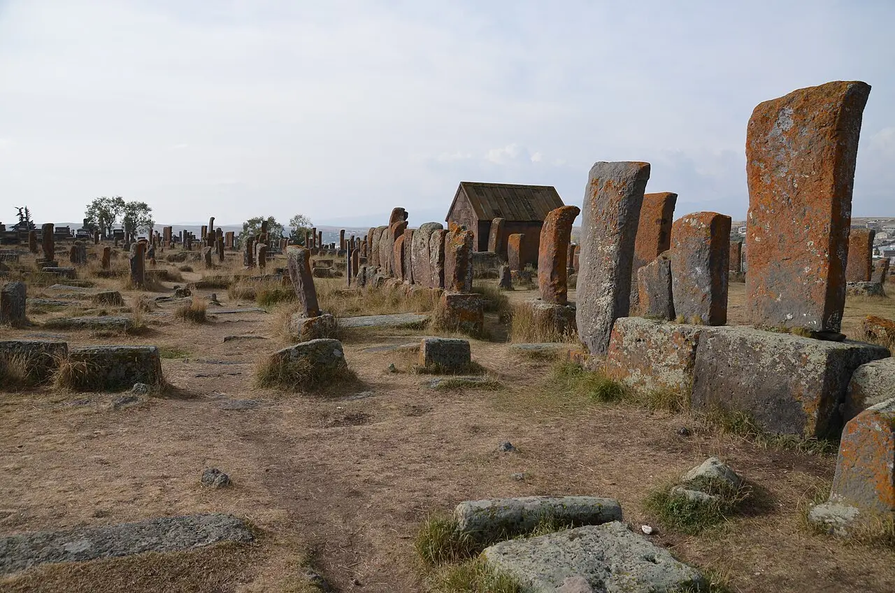
A short way further, near the village of the same name, is the sight that alone justifies the drive: the Noratus cemetery, the largest surviving field of khachkars in the world. A khachkar is an Armenian carved memorial cross-stone, and here almost a thousand of them stand in a seven-hectare meadow, the oldest dating to the late 10th century, each one a different pattern of interlaced crosses and rosettes. It became the largest field of its kind after the medieval khachkars at Old Julfa were destroyed, which gives the place a quiet weight. Walk in among them: some lean, some are furred with orange lichen, a few carry little carved scenes of a wedding or a funeral feast. Give it an hour and take your time. Our full guide to the Noratus khachkars explains what to look for on the stones and the folklore the village tells about them. Cross-stone hunters can line this up against the country’s other great carvings in our roundup of the best monasteries in Armenia.
Gavar and the south shore
A few kilometres inland from Noratus is Gavar, the capital of Gegharkunik province and, at around 20,000 people, the biggest town on this side of the lake. It’s not a sight in itself and no guide should pretend otherwise: it’s a plain Soviet-era grid with a market, a couple of churches and honest, cheap food. What it’s good for is logistics. This is the sensible place to fill up, buy lunch, and, on the two-day version, sleep, so that the Selim pass is a fresh-morning drive rather than a tired afternoon scramble.
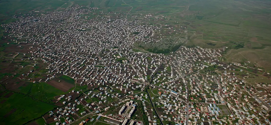
From Gavar the road runs on down the south shore to Martuni, about 30 km on, past long stretches of open water and, in summer, roadside stalls selling smoked sig and ishkhan, the lake’s whitefish and its prized endemic trout. Martuni is where the loop leaves the lake for good and turns uphill. There are hotels and guesthouses at intervals all along this shore if you’d rather sleep with the water in view than in town, and our guide to where to stay on Lake Sevan sorts the beach resorts from the quieter options.
Over the Selim pass to Orbelian’s caravanserai
This is the stretch that turns a lake outing into a proper road trip. South of Martuni the road climbs hard into the Vardenis mountains, up switchbacks onto the Selim pass, also called the Vardenyats pass, at over 2,400 m. Just below the summit on the southern side stands Orbelian’s caravanserai, a long, low hall of black basalt built in 1332 by Prince Chesar Orbelian to shelter Silk Road caravans crossing between the lake and Vayots Dzor. It’s the best-preserved caravanserai in Armenia, and stepping out of the wind into its dim, vaulted stone hall, cool and echoing, with light falling from slits in the roof, is one of those moments the loop is built around. For the inscriptions, the hall layout and when the pass is actually open, see our dedicated Orbelian (Selim) caravanserai guide.
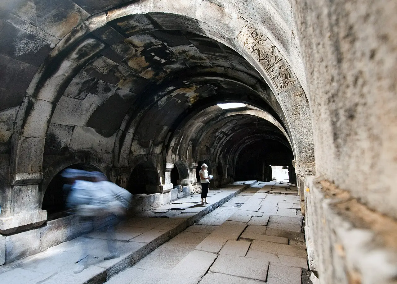
Two honest warnings about the pass. First, it’s the reason for the season: outside roughly May to November it can be under snow and shut, and even in the shoulder months a cold front can close it or ice the Vayots Dzor side, so check locally before you commit. Second, there’s nothing at the top but the caravanserai, the wind and the view, so carry water and a jacket. If you have a rental and are nervous about mountain roads, our guide to renting a car in Armenia covers the deposit, the paperwork and what these roads are actually like.
The Yeghegis detour, and the way home
Down the southern side of the pass, a side road turns up into the Yeghegis valley, and if you have the two days it’s the detour that pays off best. Tucked into this one green valley are a ridge-top fortress, a hillside monastery, a rare 13th-century Jewish cemetery and an open-air church built for blessing soldiers on horseback. It’s a lot for one valley, and rather than cram it in here we’ve given it its own write-up: see the Yeghegis valley loop for how to spend an afternoon or a morning there.
From Yeghegis you don’t double back. Drop down to Yeghegnadzor and pick up the M2 highway, which carries you back to Yerevan in about two hours through the vineyards and red cliffs of Vayots Dzor, closing the loop on a completely different road from the one you came out on. As a rough floor, the two-day self-drive version with a small rental car, a night in a Gavar guesthouse and local food starts around AMD 70,000 per person for two sharing, and climbs from there with nicer rooms and a bigger car. The monasteries and the caravanserai are free; the real costs are the car, the bed and the meals.
To fit this loop into a longer trip, browse the routes hub for more self-drive ideas, or fold the lake into a wider circuit with our 7-day Armenia itinerary. Sevan works as a day, but the loop is what turns it into a story.
Route day by day
- Days on the road
- 2
- Distance
- ≈340 km
- Budget from
- 70000 AMD
- Best season
- May, June, July, August, September
The route at a glance
-
Yerevan
Route startstop ≈0 min
Start point: pick up the rental car and head northeast on the M4 toward Sevan, about an hour of fast highway climbing gently up to the lake.
-
Sevanavank
65 km from the startstop ≈60 min
The two 9th-century churches on the peninsula at the northwest corner of the lake, up a stone staircase of about 230 steps; the postcard first view of Sevan.
Photo: GRANDE PUFFO VCO / Wikimedia Commons, CC BY-SA 4.0 ( source) -
Hayravank
100 km from the startstop ≈40 min
A small 9th-12th-century monastery right on the western shore, ringed by khachkars; almost always quiet, and the water laps the rocks below it.
Photo: Khoren Arabadjian / Wikimedia Commons, CC BY-SA 4.0 ( source) -
Noratus
118 km from the startstop ≈60 min
The largest surviving field of khachkars in the world: almost 1,000 carved cross-stones spread over seven hectares, the oldest from the late 10th century.
Photo: Carole Raddato / Wikimedia Commons, CC BY-SA 2.0 ( source) -
Gavar
125 km from the startstop ≈45 min
The provincial capital, a few kilometres inland from Noratus; a workaday town that is the natural place to stop for lunch or spend the night.
Photo: 517design / Wikimedia Commons, CC BY-SA 4.0 ( source) -
Martuni
158 km from the startstop ≈30 min
A town on the south shore where the loop turns off the lake and starts climbing toward the Selim pass; last easy fuel and coffee before the mountains.
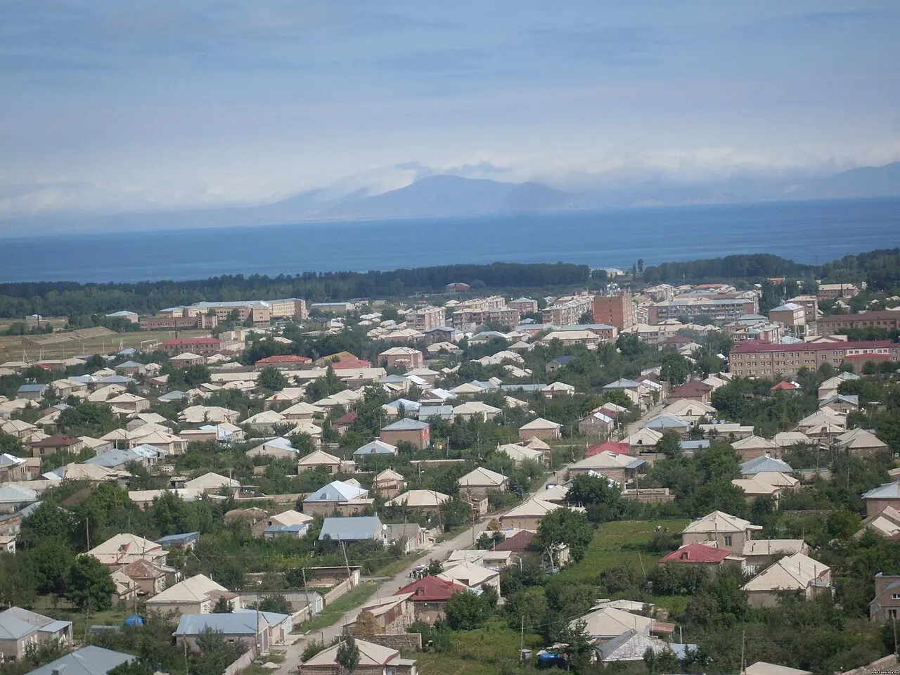
Photo: Spetsnaz1991 / Wikimedia Commons, CC BY 2.0 ( source) -
Orbelian's (Selim) Caravanserai
190 km from the startstop ≈45 min
A basalt Silk Road inn of 1332 at 2,410 m on the Selim (Vardenyats) pass, the best-preserved caravanserai in Armenia; the high point of the drive.
Photo: Shaun Dunphy / Wikimedia Commons, CC BY-SA 2.0 ( source) -
Yeghegis valley (detour)
212 km from the startstop ≈120 min
Over the pass into Vayots Dzor: a medieval side valley of fortresses, monasteries and a 13th-century Jewish cemetery. Covered in full in our Yeghegis loop.
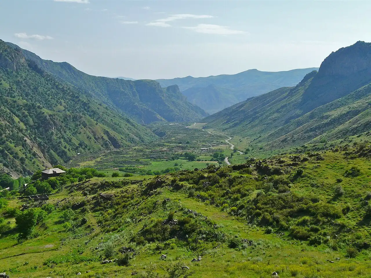
Photo: franek2 / Wikimedia Commons, CC BY-SA 3.0 ( source)
Route map
The map with stops loads on click - to keep the page lightweight.
The map didn’t load. Check your connection and refresh the page.