Best Day Hikes Near Yerevan
Day hikes from Yerevan: Mount Hatis, Mount Ara, Garni Gorge, Khosrov Forest and Dilijan forest walks, with distances, seasons and trailhead access.
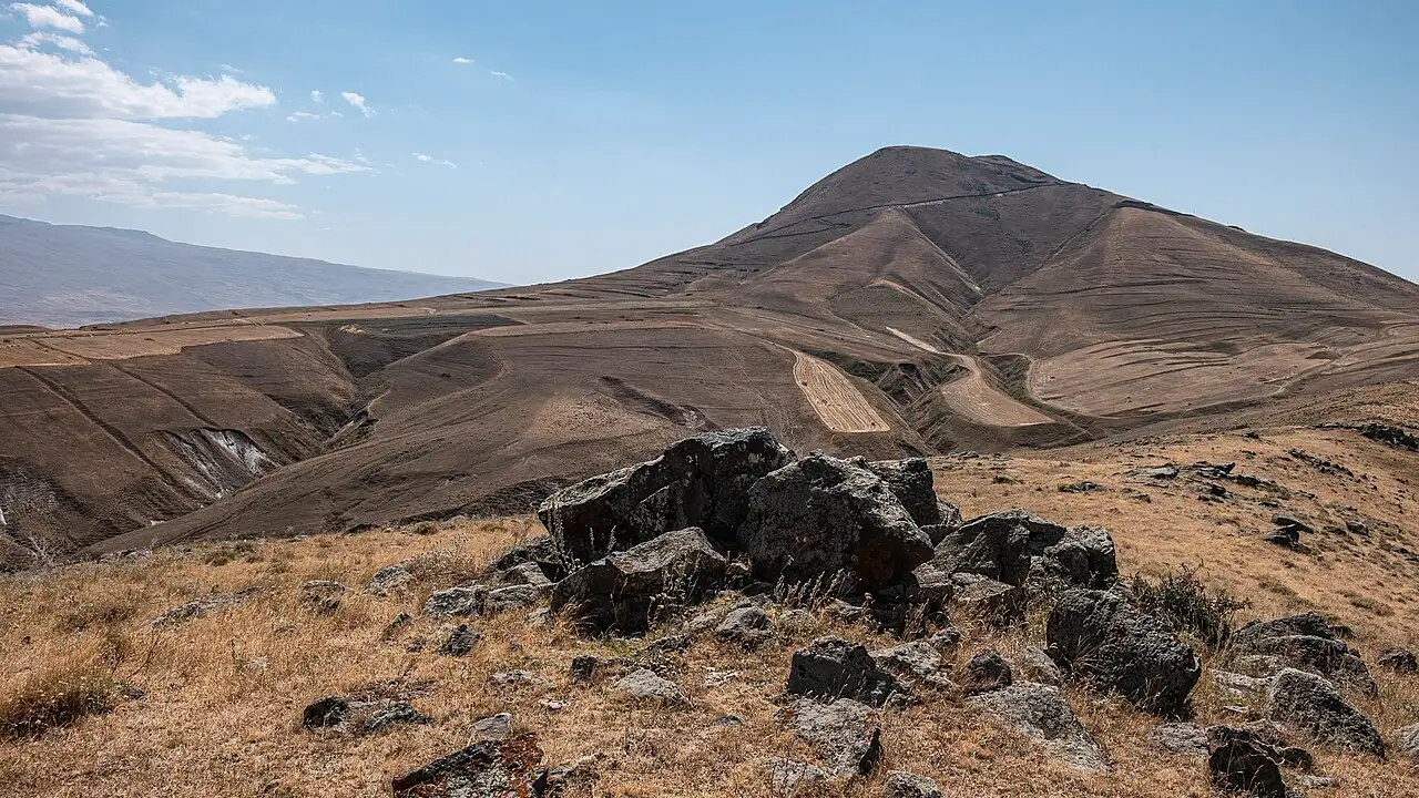
The best day hikes near Yerevan are closer than most visitors expect: within roughly an hour’s drive you can walk a basalt gorge under a Greco-Roman temple or climb a 2,528 m volcano with Ararat on the horizon. Parz Lake at 1,334 m is the forest outlier - about two hours north in Dilijan, so a long but workable day return if you start early. The capital works brilliantly as a hiking base, but almost every trailhead needs a car or a guided transfer, and the season matters more than the map because spring snow and summer heat rewrite the same slope in opposite directions.
Match the hike to your month and your legs. Garni Gorge and Khosrov Forest are the forgiving entries; Mount Hatis and Mount Ara are proper summit days with 900 m or so of climbing; Dilijan’s Parz Lake sits in between as a shaded forest outing. In July favour an early summit start or the lake; in April favour the gorge and forest tracks while the high cones still hold snow.
Garni Gorge: the easy half-day walk
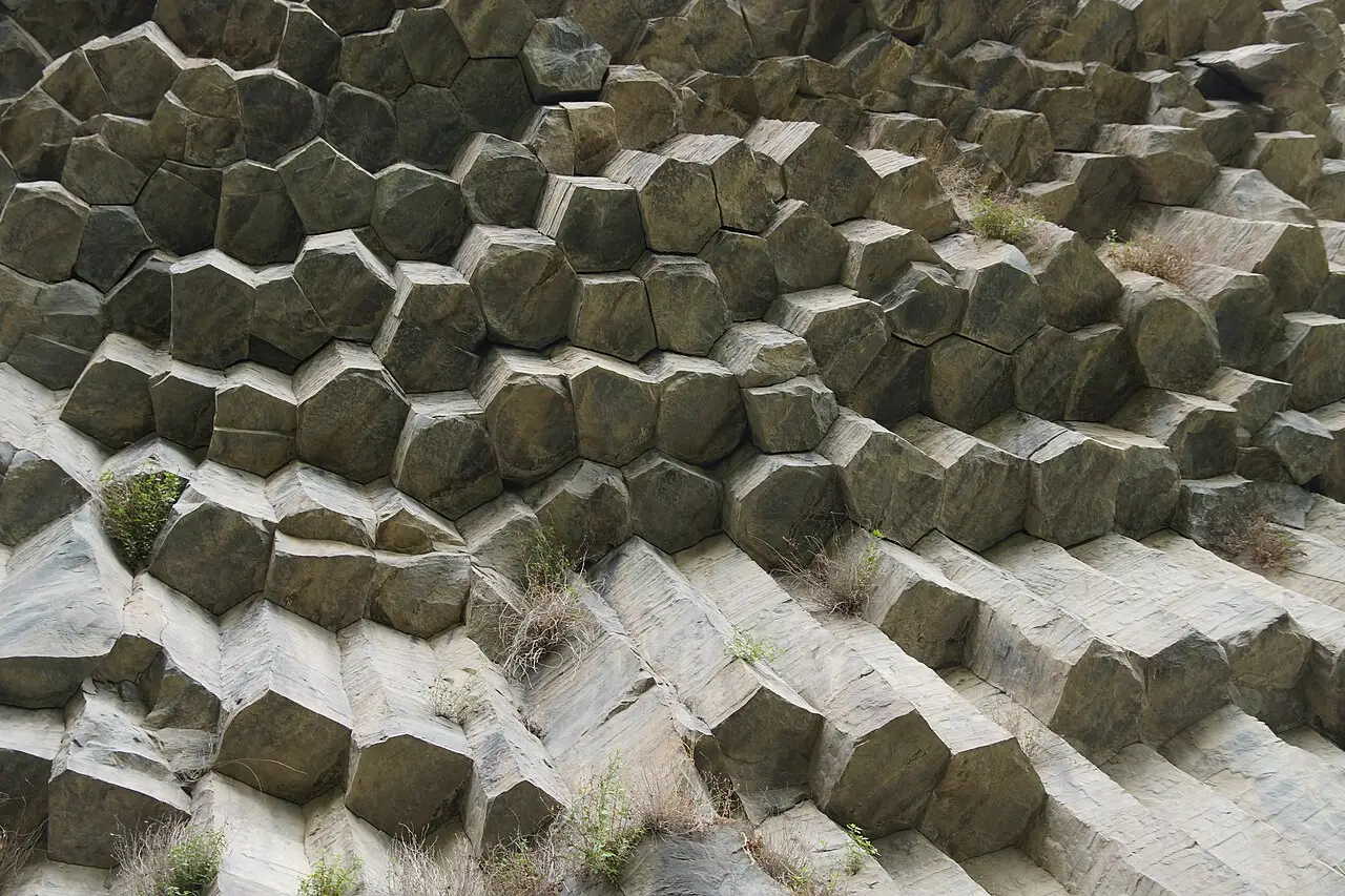
For a hike that still feels like Armenia without training for a summit, start in the Garni Gorge east of the city. Below the first-century temple, a rough track drops into the Azat River canyon to the Symphony of Stones, a wall of hexagonal basalt columns formed as lava cooled and cracked. Operators and trail notes commonly describe it as about 2 km each way on a stony path, roughly half an hour down and a bit longer back up, and it’s among the few outings here that fit beside temple tickets and a lavash lunch without dominating the whole day.
The gorge walk pairs naturally with Garni temple and Geghard monastery in a single eastern loop; our Garni and Geghard day-trip guide covers tickets, the temple plateau and how long the combination takes. In high summer the canyon shade is welcome, and you’ll share the path with day trippers who never go farther than the columns. That’s fine: the geology is the spectacle, not the altitude.
Khosrov Forest: canyon trails without a summit
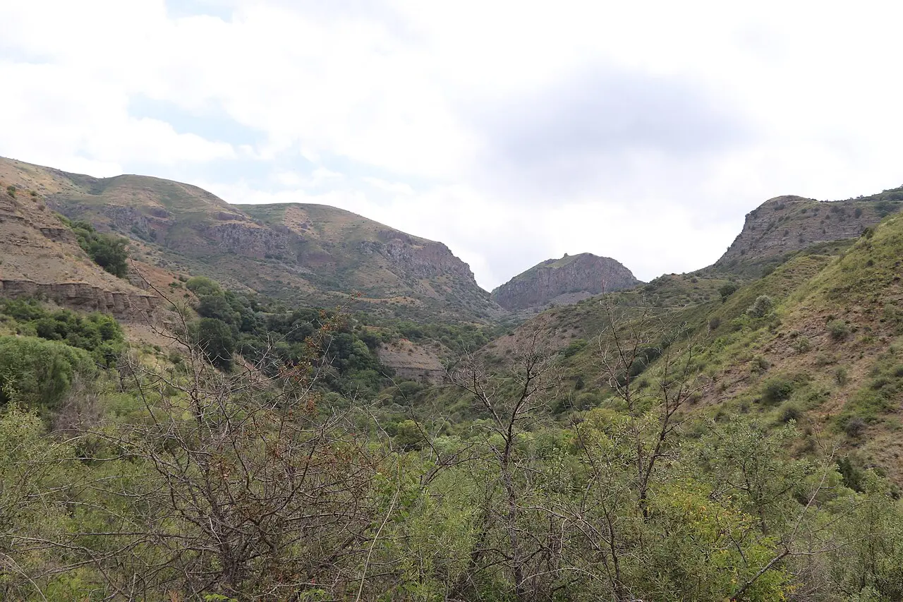
South of Garni, Khosrov Forest State Reserve protects roughly 23,000 hectares of juniper scrub, cliffs and river canyon in the basins of the Azat and Vedi rivers (Ararat Province), not the Hrazdan. Founded in 1958, it’s among the oldest protected areas in Armenia, and the walking here is gentler than Hatis or Ara: forest tracks, viewpoints over the gorge, and spring wildflowers instead of a bare summit push.
Khosrov is a strict state reserve, and that changes the mechanics: you need a permit arranged in advance, not a ticket bought at a gate, and a guide is normally expected. Operators sell the permit as a line item inside a tour, which is the simplest route in. No official tariff is published anywhere - the reserve’s old domain no longer belongs to it - so treat the figures you’ll see quoted (entry in the low thousands of dram, a guide from about 10,000 AMD) as reports, not a published tariff, and settle the total with your operator before you commit to the day. There is no single famous loop signposted like a European national park, so the guide also decides which tracks are open that week. Allow a full day for several hours on foot plus the drive; it’s closer than Dilijan but feels wilder than the temple circuit.
Mount Hatis: the closest real summit
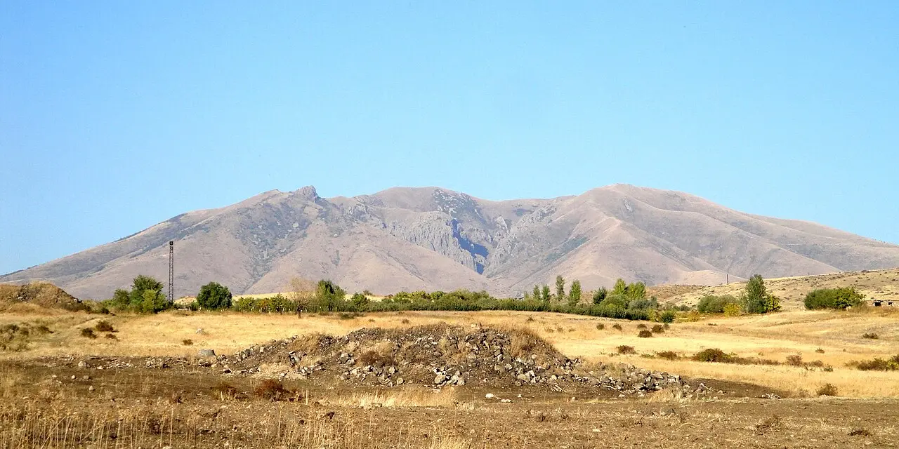
Mount Hatis at 2,528 m is the volcano you can see from parts of Yerevan, a conical massif in Kotayk about 35 km northeast of Republic Square. Commercial day hikes quote roughly 11 km round trip with 900-950 m of climbing from the village trailheads at Kotayk or Kaputan, which sit near 1,700 m - that’s the number to plan your legs around. The Armenian Mountaineering Federation’s route sheet gives 1,363 m of ascent over 11.04 km, which only works from a start well below the villages, so don’t add the two together.
It’s a full day, not a stroll: plan six to seven hours on the mountain plus driving, start early before afternoon clouds build, and wear proper boots because the upper slopes are rocky and exposed. From the top, on a clear day, you’ll pick out Aragats, Ararat, the Gegham range and the Kotayk plateau in one sweep - that’s why locals treat Hatis as the introductory summit before bigger objectives like Mount Aragats and Lake Kari. Mobile coverage is patchy on the lower slopes; carry a downloaded map and tell someone your route.
Mount Ara: crater chapel and legend
Mount Ara (often called Ara Ler) is a separate extinct volcano on the Kotayk-Aragatsotn border, about 40 km from the capital. Guide operators and trekking pages cite heights between 2,577 m and 2,605 m depending on which benchmark they use; treat ~2,600 m as the working figure. The usual day hike is 11-12 km round trip with 870-900 m of gain, three to five hours of walking, and the sweet seasons are April to June and September to November when the meadows are green or crisp and the summer haze is lower.
The payoff is unusual: a rock-cut chapel (Tsaghkevank / Virgin Varvara) inside the crater, a pilgrimage spot with a spring locals credit with healing properties, plus wide views toward the Aparan reservoir and Aragats. Legend ties the mountain to King Ara the Beautiful; you’ll hear that story from any guide who climbs it regularly. It’s marginally harder to organise than Hatis because access villages differ (Saghmosavan, Yernjatap, Aragyugh side), so a guided day or a driver who knows the current track condition saves time.
Dilijan and Parz Lake: forest day from the city
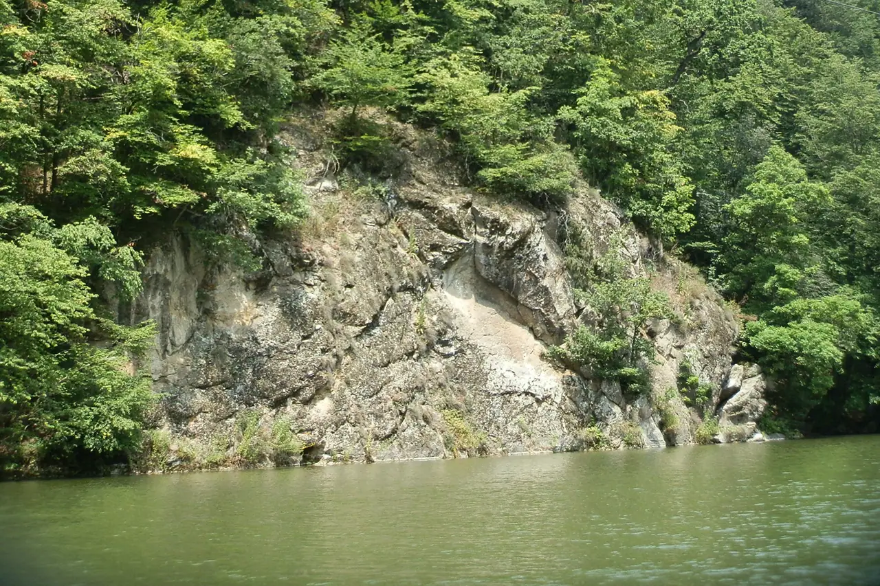
When the volcanic tops are too hot or too snowy, head north on the M4 to Dilijan National Park. Parz Lake sits at 1,334 m in beech forest, a small emerald sheet of water with loop paths that stay cool when Yerevan hits 35°C. The drive is about 110 km and two hours each way on two routing engines, so you’re committing four hours behind the wheel - a long day from the capital, but workable if you leave early.
You won’t need summit gear: trainers are fine on the lake loop, though mud appears after rain. Our Dilijan town guide covers monasteries and lunch stops, and the dedicated Dilijan hiking trails page breaks down longer marked routes beyond a lake stroll. Pair it with a morning start and you’ll be back in Yerevan for wine on Saryan Street by evening.
Picking your day: a quick comparison
| Hike | Drive from Yerevan | Round-trip distance | Climbing | Best for |
|---|---|---|---|---|
| Garni Gorge | ~30 km / ~1 h | ~4 km | Minimal | First-timers, temple combo |
| Khosrov Forest | ~35-45 km / ~1 h | Variable forest walks | Low-moderate | Shade, no summit pressure |
| Mount Hatis | ~35 km / ~58 min | ~11 km | ~900-950 m from the villages | First summit, big views |
| Mount Ara | ~40 km / ~1 h | ~11-12 km | ~870-900 m | Crater chapel, legends |
| Parz Lake (Dilijan) | ~110 km / ~2 h | ~3-8 km loops | Low | Summer heat, families |
For the bigger country picture - Smbataberd, Azhdahak, Khustup and multi-day routes - see our country guide to hiking in Armenia. If you’re already planning a high day on Aragats, that page and the Aragats and Lake Kari guide overlap less than you’d think: Hatis and Ara are weekday warm-ups, Aragats is the altitude test.
Safety, season and insurance
Mountain weather turns fast. Start at dawn, carry two litres of water per person on Hatis and Ara, pack a wind layer even in July, and turn back if clouds stack on the ridge. Shepherd dogs appear on many slopes; give flocks space and don’t throw stones. There’s no reliable shelter or water service on the bare tops - Hatis has a cave and old bunkers, but treat them as landmarks, not a plan B.
April and May can still hold snow above 2,000 m; July and August are best for high summits but brutal in the sun; September gives crisp light on Hatis and Ara. Garni and Khosrov extend the season on either side. The free HIKEArmenia information centre in Yerevan publishes trail updates - worth a stop the day before you climb.
Hiking days are exactly when travel insurance matters: a sprained ankle on Hatis still means a taxi to a private clinic that expects payment upfront. Travel insurance for Armenia explains medical cover and altitude add-ons; you can quote a policy for your dates before you book the rental car.
Getting to the trailheads
There is no useful public transport to the Hatis or Ara trailheads, and Khosrov visits normally need a booked guide with transfer. Marshrutkas do reach Garni village, but the gorge walk still wants a short local hop or a day tour that includes the canyon. Count on renting a car or a guided hiking day that includes 4x4 access where tracks are rough. Dilijan is the other partial exception - occasional marshrutkas run north, but a car still wins for Parz Lake timing.
From Republic Square, budget roughly an hour to Hatis or Garni and about four hours round-trip driving for a Dilijan lake day. Taxis to villages are possible but you’ll struggle to get a return pickup from a mountain track; negotiate wait time or book through a tour operator. Our wider getting around Armenia guide covers intercity buses; for these hikes, treat Yerevan as the hub and the trailhead as a deliberate car destination.
If you’re staying central, stack an outdoor day with city sights using our Yerevan city guide list - the Cascade one evening, Hatis the next morning works better than you might expect.
Photos
Read also

Entertainment · 10 min read
Paragliding in Armenia: Where to Fly Tandem
Verified · September 3, 2026Tandem paragliding in Armenia: Sky Club, AERO CLUB and Armenian Geographic prices (30,000-85,000 AMD), launch sites, season and how to book.

Entertainment · 9 min read
Yerevan Nightlife: Bars, Clubs & Live Music
Verified · August 28, 2026Saryan wine bars, Pushkin jazz at Malkhas, Dargett craft beer, Club 12, late food and night safety tips for central Yerevan.

Entertainment · 8 min read
Yerevan Wine Days: The City's Street Wine Festival
Verified · August 26, 2026Yerevan Wine Days in early June: free street entry, tasting package, Saryan and Tumanyan routes, and how it differs from Areni and year-round bars.
Entertainment · 8 min read
Erebuni-Yerevan Day: The City's October Birthday
Verified · August 25, 2026Erebuni-Yerevan Day 2026 was celebrated on 9 and 10 October: concerts on stages across Yerevan, a children's zone and fireworks. Dates move each year.