Aragatsotn Day Loop: Alphabet, Amberd and the Kasagh Gorge
A one-day self-drive loop through Aragatsotn: Oshakan, Saghmosavank on the Kasagh gorge, the Alphabet Monument, Amberd fortress, Lake Kari and Byurakan.
You can pack the whole province of Aragatsotn into one long day from Yerevan, and it’s one of the best days in Armenia if you like your sightseeing with a theme running through it. The theme here’s words and stone: the grave of the man who invented the Armenian alphabet, a field of giant carved letters, two monasteries perched over a river gorge, and a mountain fortress at 2,300 m. This loop threads them together on a single tank of fuel, climbing from the Kasagh gorge up the flank of Mount Aragats to an alpine lake and back down through the old capital of the province. It is roughly 157 km round trip, and the only thing standing between you and doing it comfortably in a day is the mountain weather up top.
Start with the honest logistics, because this route only really works with a car. The gorge monasteries, the alphabet letters and the Aragats road all sit on their own spurs off the main highway, and there’s no bus that links them. It’s a self-drive day, and a full one: budget an early start and do not dawdle over lunch if you want the mountain in the afternoon with light to spare. The one hard constraint is Lake Kari. The paved road up to it only opens from about mid-May to mid-October, and snow can shut it either side of that; if the top is closed, or you are here in winter, simply cut Kari and Amberd and keep the gorge and the alphabet, which are a rewarding half-day on their own.
Oshakan: where the alphabet is buried
Twenty minutes northwest of Yerevan, just short of Ashtarak, is the village of Oshakan, and it’s the right place to begin because it explains everything else. This is the burial place of Mesrop Mashtots, the monk and scholar who invented the Armenian alphabet around 405 AD, giving a people their own script and, arguably, the thing that has held them together ever since. Mashtots died in 440, and three years later a chapel was raised over his grave. The church you see now, the Church of Saint Mesrop Mashtots, was rebuilt over that spot between 1875 and 1879, and his tomb lies in the crypt beneath the altar, usually with a candle or two burning.
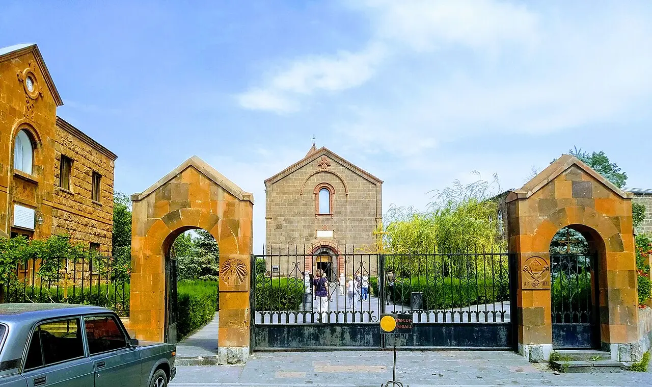
It takes half an hour, and it is worth reading the walls: around the churchyard stand carved stone versions of the thirty-nine letters, a small preview of the giant set you’ll meet later. This is a pilgrimage spot for Armenians, and first-graders are traditionally brought here when they learn to read, so you may share it with a class of small children, which is rather the point.
Saghmosavank on the Kasagh gorge
From Oshakan, drive north up the side of the Kasagh river gorge, a green canyon that cuts down through the plateau, to Saghmosavank. This 13th-century monastery is built right on the lip of the gorge, so close that the drop falls away sheer from below its walls, and the setting is the whole point: dark stone buildings, the ravine, and the huge bulk of Aragats filling the sky behind. It was raised by the Vachutian princes, the local lords of the day; the main Church of Zion dates from 1215, and the covered hall attached to it was added by Kurt Vachutian in 1255, with a book-depository alongside where manuscripts were once copied and kept.
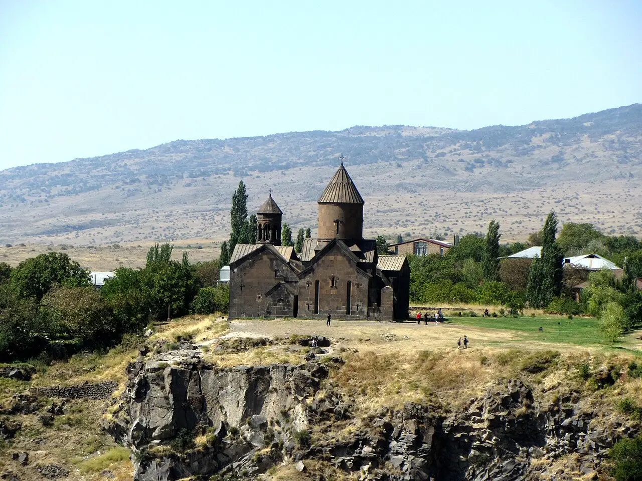
Walk around the back to the gorge edge for the view down, and if you have a spare half hour, its near-twin Hovhannavank stands about five kilometres south on the same rim. Monastery-lovers can line these up against the country’s headline sites in our roundup of the best monasteries in Armenia.
The Alphabet Monument
A few minutes on, near the village of Artashavan on the lower slopes of Aragats, is the sight that gives the loop its name: the Armenian Alphabet Monument. This is a field of thirty-nine massive letters carved from local tuff, one for each character of the alphabet, set up in 2005 for the 1,600th anniversary of Mashtots’s invention and designed by the architect Jim Torosyan. Statues of Mashtots and other figures of Armenian letters stand among them.
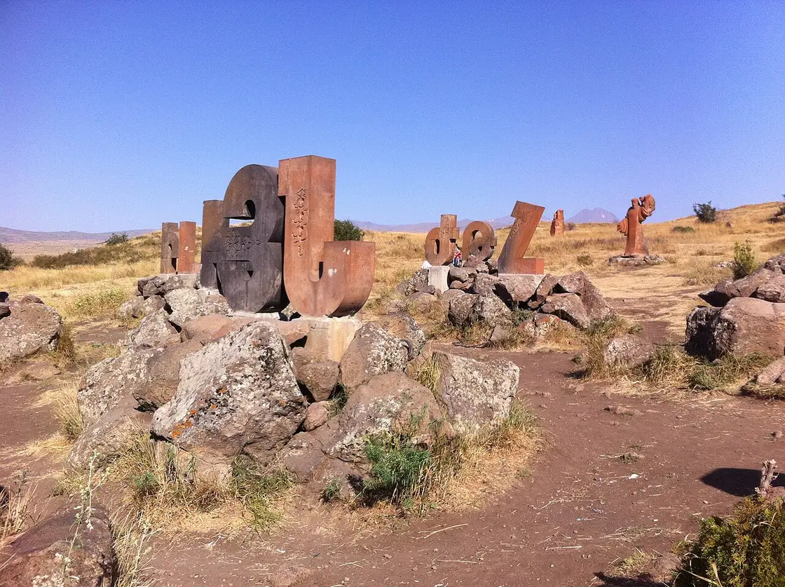
It sounds like it might be a gimmick and somehow isn’t. Armenians treat their alphabet as a national treasure, families come to find the first letter of their name and photograph the children beside it, and after Oshakan and Saghmosavank the letters land differently than they would cold. Give it fifteen minutes, then point the car uphill. If you would rather take just these two at an easier pace, they also make a tidy half-day from Yerevan on their own - our guide to Saghmosavank and the Alphabet Monument covers the monastery, the letters and the gorge walk between them.
Up Aragats: Amberd and Lake Kari
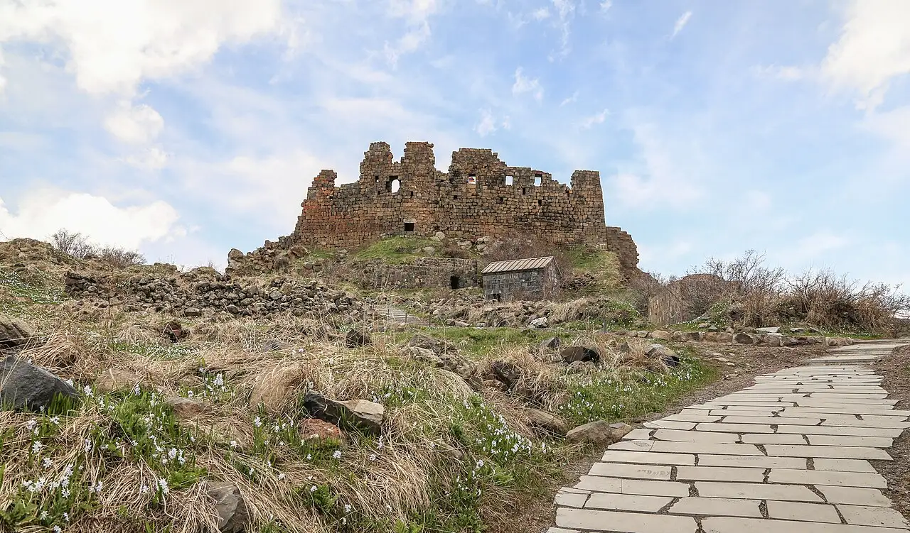
Now the road climbs. Amberd is a stone fortress on a green spur of Aragats at about 2,300 m, where two mountain streams meet in deep ravines that did its defending for it. The castle and its first walls go back to the 7th century, it was the stronghold of the Pahlavuni and later the Vachutian princes, and the handsome Vahramashen church beside it was built by Vahram Pahlavuni in 1026 before the Mongols sacked the place in 1236. It’s a genuinely atmospheric ruin, wind and grass and old stone, and the drive up is half the reward. Our full guide to Amberd fortress covers its dynastic history, the siege waterworks and how to time a visit.
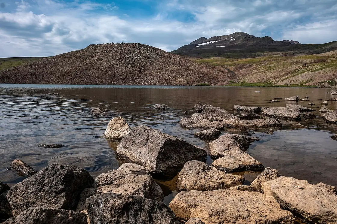
Higher still, where the paved road runs out, is Lake Kari, a small alpine lake at about 3,200 m ringed by the four peaks of Aragats. This is the seasonal part of the day and the reason to check the forecast: the road is generally open only mid-May to mid-October, and it’s cold and windy up here even when Yerevan is baking, so carry a jacket whatever the valley says. Because the mountain, the summit hike and the altitude deserve their own detail, we’ve covered them in full in our guide to Mount Aragats and Lake Kari; this loop just takes in the lake and turns back.
Byurakan Observatory and the way home
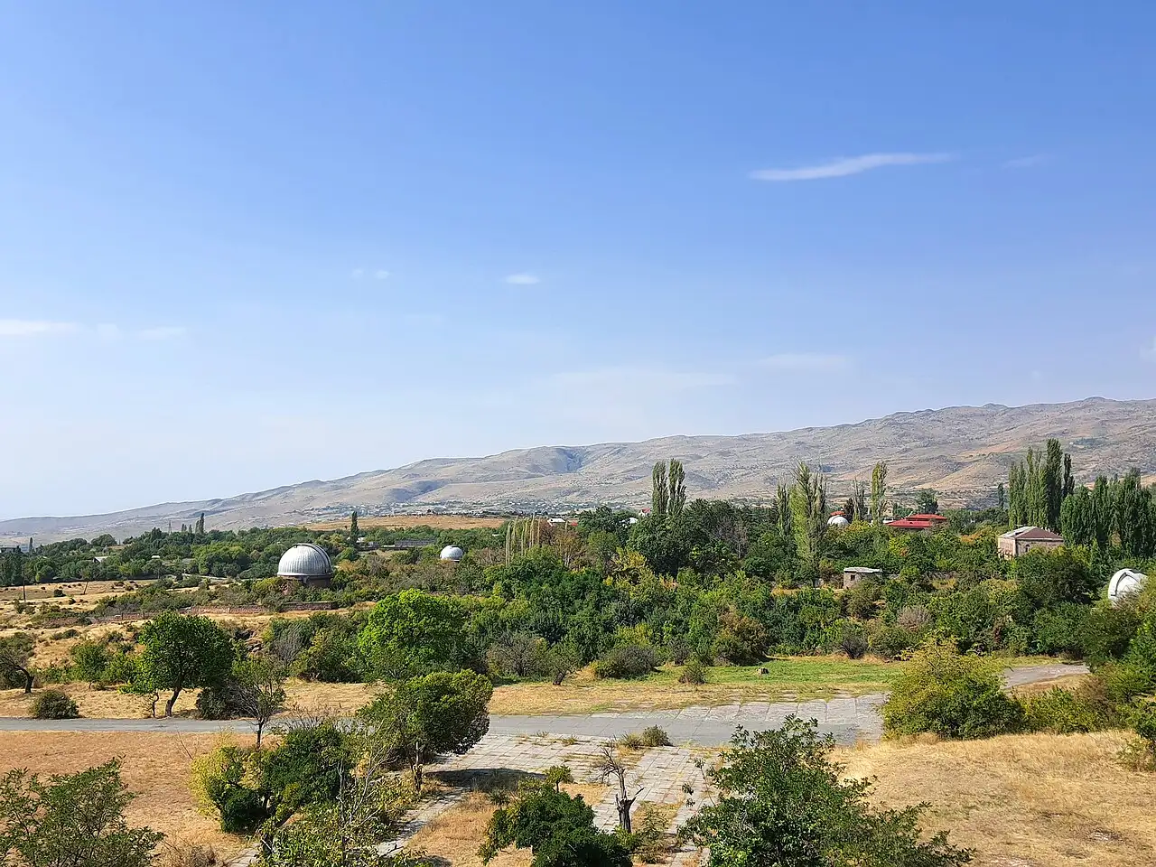
Coming back down, stop at Byurakan, where the Byurakan Astrophysical Observatory sits on the slope at about 1,400 m. Founded in 1946 by the astronomer Viktor Ambartsumian, it was one of the great observatories of the Soviet Union, and its 2.6 m reflector and 1 m Schmidt telescope are still working instruments. You can visit the grounds and, by arrangement, the domes and the small museum, though opening is limited, so it is worth calling ahead rather than turning up cold. Even from outside, the setting of white domes against the mountain is a fine thing. For night telescope sessions, tour prices and the booking number, see our dedicated Byurakan Observatory guide.
The last stop before Yerevan is Ashtarak, the capital of Aragatsotn, strung along the same Kasagh gorge you followed in the morning. It’s a pleasant town for a late coffee, and it hides two things worth the stop: the miniature Karmravor church, a 7th-century chapel barely bigger than a room and one of the best-preserved of its age in the country, and the old three-arched bridge of 1664 down in the gorge. From Ashtarak it’s a twenty-minute run back to the city.
Costs, timing and how to shape it
As a rough floor, the day works out from around AMD 35,000 per person for two people sharing a small rental car, once you count fuel, lunch and a coffee; the monasteries, the alphabet field and Amberd are free, and Byurakan asks only a small fee if you arrange a visit. The real variable isn’t money but daylight and weather. In full summer you have the hours to do the whole loop at a walk; in spring or autumn, when Kari may be shut, treat the gorge and the alphabet as the core and the mountain as a bonus.
If you would rather not drive the mountain roads yourself, or you want the geology and history filled in, this loop overlaps neatly with several of the region’s classic outings, and you’ll find it among our best day trips from Yerevan. To sort out the car first, our guide to renting a car in Armenia covers the deposit, the paperwork and what these gravel-and-switchback mountain roads are actually like. For more ways to build a trip, browse the routes hub.
Route day by day
- Days on the road
- 1
- Distance
- ≈157 km
- Budget from
- 35000 AMD
- Best season
- June, July, August, September, October
The route at a glance
-
Yerevan
Route startstop ≈0 min
Start point: pick up the rental car and head northwest on the M3 toward Ashtarak and the province of Aragatsotn.
-
Oshakan
27 km from the startstop ≈40 min
The village where Mesrop Mashtots, inventor of the Armenian alphabet, is buried; his tomb lies in the crypt of the 19th-century church built over it.
Photo: Preacher lad / Wikimedia Commons, CC BY-SA 4.0 ( source) -
Saghmosavank
46 km from the startstop ≈45 min
A 13th-century monastery built by the Vachutian princes right on the lip of the Kasagh river gorge; the Church of Zion dates from 1215.
Photo: Armen Manukov / Wikimedia Commons, CC BY-SA 4.0 ( source) -
Alphabet Monument
51 km from the startstop ≈30 min
Thirty-nine giant tuff letters standing in a field near Artashavan, carved in 2005 for the 1600th anniversary of the Armenian alphabet.
Photo: Edgar Keshishian / Wikimedia Commons, CC BY-SA 4.0 ( source) -
Amberd fortress
73 km from the startstop ≈75 min
A stone fortress on a spur of Aragats at 2,300 m, its walls 7th-13th century, with the Vahramashen church of 1026 beside it.
Photo: Saro Hovhannisyan / Wikimedia Commons, CC BY-SA 4.0 ( source) -
Lake Kari
90 km from the startstop ≈45 min
An alpine lake at about 3,200 m on the upper slopes of Aragats, reached by a paved road that is generally open only from mid-May to mid-October.
Photo: Wowan1978 / Wikimedia Commons, CC BY-SA 4.0 ( source) -
Byurakan Observatory
117 km from the startstop ≈30 min
The astrophysical observatory founded by Viktor Ambartsumian in 1946, at about 1,400 m; home to a 2.6 m reflector and a 1 m Schmidt telescope.
Photo: XenonX88 / Wikimedia Commons, CC BY-SA 4.0 ( source) -
Ashtarak
134 km from the startstop ≈45 min
The provincial capital in the Kasagh gorge, with the tiny 7th-century Karmravor church and a three-arched bridge of 1664; last stop before Yerevan.
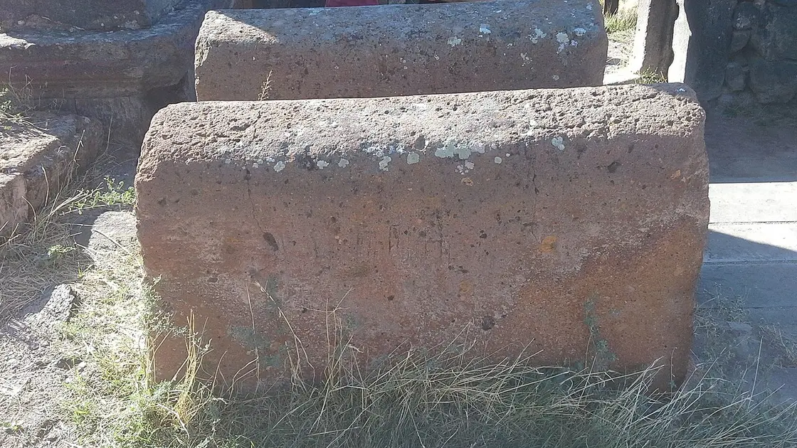
Photo: Lilitik22 / Wikimedia Commons, CC BY-SA 4.0 ( source)
Route map
The map with stops loads on click - to keep the page lightweight.
The map didn’t load. Check your connection and refresh the page.