Deep South Armenia: Goris to Meghri Road Trip
Goris to Meghri via Tatev-Aghvani, Kapan and Shikahogh: 2 days, inland M2 detours, Tatev cable fares, and US/UK advisories checked 13 Aug 2026.
From Goris you can drive Armenia’s deep south in two solid days: the Wings of Tatev, the inland Tatev-Aghvani road to Kapan, a permit-backed stop at Shikahogh, and the drop into Meghri before the Iran border at Agarak. Count on roughly 200 km one way if you chain Tatev, Kapan and the Meghri Pass via Kajaran; add time if you take the slower forest line through Shikahogh and Tsav. This is the continuation past where our southern Armenia road trip stops at Tatev - different road, different risk picture, different overnight maths.
The catch isn’t scenery. It’s which asphalt you choose and what your government says about the miles south of Kapan. Read the advisory block before you book a car.
Advisories checked 13 August 2026 - not a safety verdict. The US State Department rates Armenia Level 2 overall and lists the Azerbaijan border region as Do Not Travel. Separately, U.S. Embassy employees and their families cannot travel for non-essential reasons to Syunik east of Goris or Syunik south of Kapan (Armenia advisory entry dated 5 September 2025, read via the official RSS feed on 13 August 2026). The UK FCDO, still current on 13 August 2026, advises against all travel within 5 km of the entire eastern Armenia-Azerbaijan border (insurance can be void if you go against that advice). We are not calling this corridor “safe.” Re-check travel.state.gov and gov.uk/foreign-travel-advice/armenia the morning you leave - wording moves.
Two days that actually fit
Sleep in Goris the night before. Day one is Tatev in the morning and Kapan by evening. Day two is either a Shikahogh morning plus the Meghri Pass, or the longer forest run toward Tsav if you’ve arranged reserve access and you’re willing to stay near the eastern frontier longer. Either way, don’t try to bolt Yerevan-Tatev-Meghri in one daylight push - that turns the cable car into a checkbox and the south into a windscreen.
If you’re still north of Goris, stage the arrival first with Yerevan to Goris and Tatev. For beds in town before the deep push, where to stay in Goris is the practical list.
Goris: start full, leave early
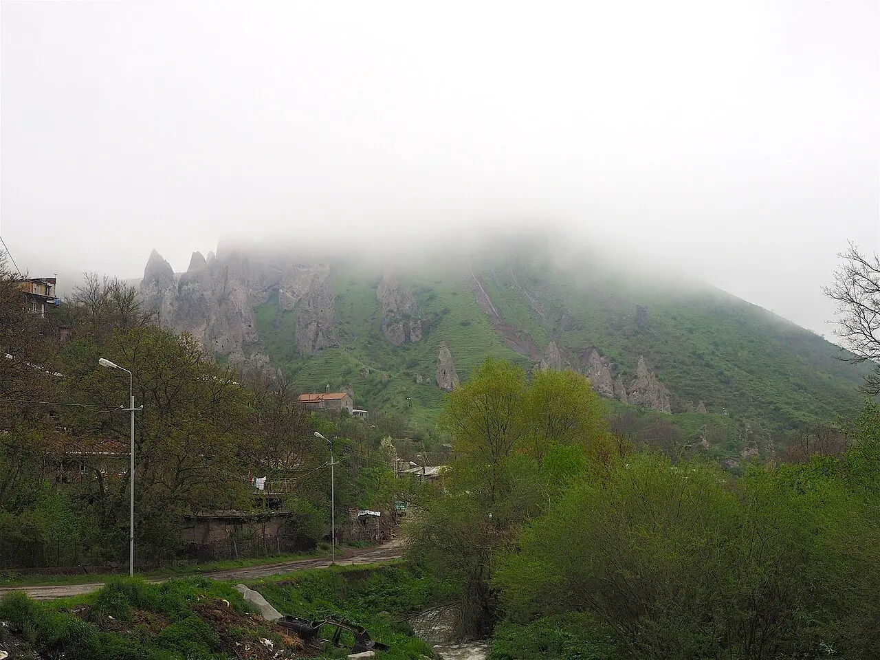
Goris is the last easy base with a real choice of guesthouses, ATMs that usually work, and petrol pumps that don’t feel theoretical. Fill up here. The rock cones and the grid of stone streets are worth a walk the evening you arrive; Old Khndzoresk is an 8 km side trip if you’ve got a spare half-day, but it’s optional on this itinerary - the deep south starts when you turn toward Halidzor.
Leave early enough that you’re at the Halidzor Wings of Tatev station with margin. Mondays are a hard miss: the cableway does not run.
Tatev first - then the inland road south
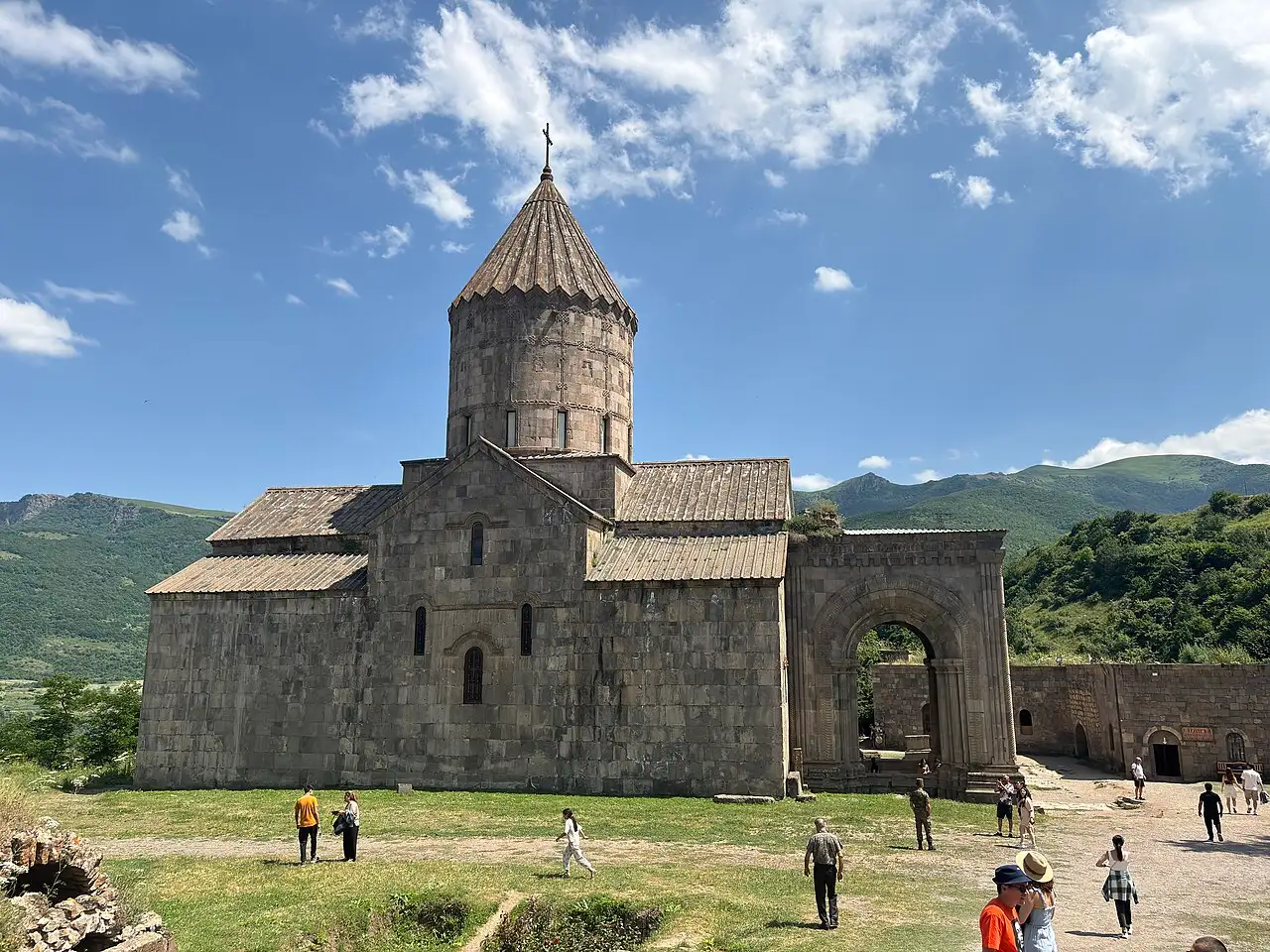
The Wings of Tatev is still the reason most people come this far south: 5,752 m of reversible cable across the Vorotan gorge, the Guinness record for the longest non-stop double-track aerial tramway of its type. Per the operator’s tariff page on tatever.am (read 13 August 2026), it runs Tuesday to Sunday and public holidays in every season - Mondays closed all year. Hours: 10:00-19:00 May-September (last cabin 18:45), 10:00-18:00 in March-April and October-November (last 17:45), and 10:00-18:00 in December, February and from 2 January (first cabin 10:30, last 17:30). Round trip is 9,000 AMD from March to November and 5,500 AMD in December-February; one-way 6,500 / 4,000 AMD; children up to 140 cm 1,000 AMD. Weather and technical stops happen - check the site the morning you drive.
The monastery at the far end is free to enter and still a working church. Cover shoulders and knees, keep your voice down, and give yourself an hour on the plateau before you think about Kapan. Full ticket quirks and gorge logistics live in our Wings of Tatev and Tatev monastery guide - don’t reinvent the timetable from an old blog.
From Tatev toward Kapan you want the inland Tatev-Aghvani alignment (and the related Ltsen-Tatev approaches that now carry much of the north-south traffic), not the old Goris-Kapan M2 stretches that ran along - and in places across - territory that came under Azerbaijani control after 2020. Those frontier-hugging segments are exactly where advisory language about the border region bites. Follow current local signage toward Aghvani and Kapan; treat navigation apps as a hint, not a legal map of who controls which verge.
Kapan overnight
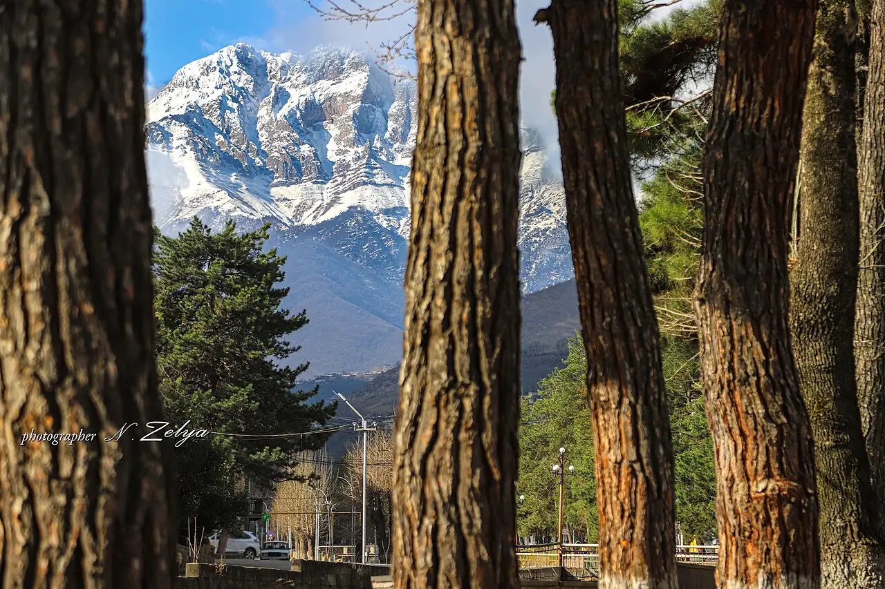
Kapan is Syunik’s working capital: copper-mining town, valley floor, Mount Khustup on the skyline. It’s the right place to sleep because everything south of here sits deeper inside the geography the US embassy flags for its own staff (“Syunik region south of Kapan”) and closer to the FCDO’s 5 km eastern-border rule. Spend the evening on fuel, cash and a simple dinner; decide in the morning whether Shikahogh is a guided morning or a skip.
Shikahogh: reserve rules, not a casual pull-off
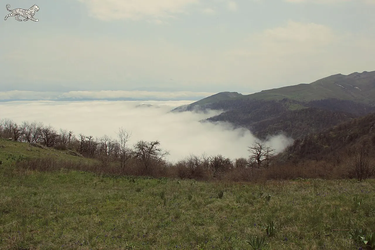
Shikahogh State Reserve has been protected since 1958 as part of the Zangezur Biosphere Complex - oak, beech and hornbeam forest on the slopes between about 700 and 2,800 m, with a relict ash grove the complex exists to keep. Infokapan’s reserve page is blunt: you need a permit in advance and guided accompaniment by Zangezur Biosphere Complex specialists inside the reserve. We couldn’t find a clean public ticket price on that page, so don’t budget a made-up fee - call or message the complex through Kapan tourism contacts before you assume you can walk in.
Driving the public road through the villages of Shikahogh and Tsav is not the same as entering the strict reserve core. If you only want forest views from the asphalt, say so when you ask - and still read the border advisories, because this line sits nearer the eastern frontier than the Kajaran climb does.
Meghri and the last Armenian miles
Two ways finish the map. The standard cargo and tourist line from Kapan is west then south over Meghri Pass via Kajaran - a paved, switchback climb to about 2,535 m, still the high paved pass on this corridor while the multi-year Kajaran tunnel project (groundbreaking reported mid-2026) is years from replacing it. The slower scenic option continues through the Shikahogh/Tsav country toward the Araks and then west to Meghri; it’s longer, quieter, and sits closer to advisory language about the eastern border. Pick with your passport country’s advice open on your phone, not with a blog’s “we weren’t stopped” anecdote.
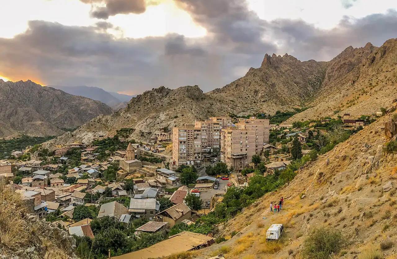
Meghri itself is the subtropical end of Armenia: figs and persimmons in season, fortress ruins above the old quarters, and the staging town for anyone continuing to Iran at Agarak. Crossing into Iran is a separate decision with its own Level-4 / “against all travel” stack - use our Armenia-Iran border crossing guide and your government’s Iran page, not this road-trip page, for that call.
The car, the detour and the tank
You need your own wheels. Marshrutkas will get you Goris-Kapan-Meghri in pieces on a good day, but they won’t wait while you ride the cable car, and they won’t thread a reserve appointment. Rent in Yerevan, confirm mileage and mountain cover, and read driving in Armenia plus car rental in Armenia before you sign.
Drive the current inland detours - Tatev-Aghvani toward Kapan, then either Kajaran-Meghri Pass or the forest line you’ve cleared with local advice. Do not improvise “shortcuts” east toward the Azerbaijan line. Roadworks still appear on Syunik approaches (Road Department notices through 2025-2026); leave daylight margin and don’t plan the Meghri Pass descent after dark.
Fuel: start full in Goris, top up in Kapan, and don’t count on a quiet pump in every village on the Shikahogh line. Rough floor for two people sharing a small car over two days - fuel, the cable return in season, two simple nights, food - starts around 90,000 AMD before you get fancy. Treat that as a floor, not a quote.
Where to sleep on the way
Goris for the night before Tatev. Kapan for the night before Meghri. Meghri if you’re staging the border or just want the town at dusk. Inventory changes fast this far south - compare live listings rather than trusting a two-year-old hostel name in a forum thread. Browse more routes from the /routes/ hub if you’re stitching this onto a longer Armenia ring.
What we’d do with the same two days
Morning cable at Tatev on a Tuesday-Sunday, inland road to Kapan, overnight. Next day either a booked Shikahogh morning or a clean run over Meghri Pass with stops only where the map and the advisory still agree. Skip inventing a third day of “hidden villages” east of the M2. The deep south is already remote enough when you stay on the roads Armenia actually maintains for through traffic.
If Iran is on the table after Meghri, stop reading this page and open the border guide plus your foreign ministry’s Iran advisory. If it isn’t, turn around at Meghri, sleep, and climb back north the same inland way you came.
Route day by day
- Days on the road
- 2
- Distance
- ≈200 km
- Budget from
- 90000 AMD
- Best season
- May, June, July, August, September, October
The route at a glance
-
Goris
Route startstop ≈0 min
Southern staging town. Fill the tank, sleep here the night before, and leave early for the Halidzor cable station. Old Khndzoresk sits 8 km east if you have a spare afternoon.
Photo: Clay Gilliland / Wikimedia Commons, CC BY-SA 2.0 ( source) -
Tatev (Wings of Tatev)
25 km from the startstop ≈180 min
Morning priority: cable car Tue-Sun only, then the monastery. From here the inland Tatev-Aghvani road carries you south toward Kapan - not the old frontier-hugging Goris-Kapan M2.
Photo: Well-read MountainMan / Wikimedia Commons, CC BY-SA 4.0 ( source) -
Kapan
80 km from the startstop ≈0 min
Provincial capital of Syunik and the natural overnight. Fuel, cash and a bed before you decide between the Meghri Pass via Kajaran or the slower forest road toward Shikahogh and Tsav.
Photo: Syunik / Wikimedia Commons, CC BY-SA 4.0 ( source) -
Shikahogh
110 km from the startstop ≈120 min
Strict reserve of the Zangezur Biosphere Complex since 1958. Permit and guided accompaniment required for the reserve itself - arrange ahead; the village road is not a free wander inside the protected core.
Photo: Զանգեզուր / Wikimedia Commons, CC BY-SA 4.0 ( source) -
Meghri
200 km from the startstop ≈120 min
End of the Armenian M2 before the Iran crossing at Agarak. Subtropical town, fortress ruins, and the last overnight if you are staging the border - check your government advisory before you treat that as the plan.
Photo: Vahagn Hovannisyan / Wikimedia Commons, CC BY-SA 4.0 ( source)
Route map
The map with stops loads on click - to keep the page lightweight.
The map didn’t load. Check your connection and refresh the page.