Armenia 10-Day Itinerary
A slower 10-day Armenia itinerary that adds what a week cannot: the deep south around Goris and Khndzoresk, plus Gyumri and the UNESCO north.
Ten days in Armenia is not a padded week. It is the length at which the country finally slows down and shows you the two things a seven-day loop always has to cut: the deep south around Goris, where you can give Tatev, the Khndzoresk cave village and the wine valleys the time they deserve, and the north beyond Lake Sevan, where Gyumri and the UNESCO monasteries of Lori sit a long way from the capital. The extra three days do not mean three more monasteries bolted onto the same route; they mean fewer nights spent driving back to Yerevan, and more spent waking up in the place you came to see. This itinerary is built around that idea, roughly 1,150 km at an unhurried pace with a rental car.
If a week is all you have, our 7-day Armenia itinerary is the tighter loop and the right starting point; this plan is what you graduate to when you would rather travel deep than fast. As before, it is a self-drive route at heart, because the freedom to overnight in Goris and Dilijan is exactly what the extra days are for. Roads are paved and scenic but slow in the mountains, so read driving time, not distance, and if you would rather not drive, our guide to getting around Armenia covers the marshrutkas, trains and shared taxis that reach even the far north.
What the three extra days actually buy you
Before the day-by-day, it helps to see where the extra time goes, because it is not spread evenly. A seven-day trip does Yerevan, the close monasteries and a rushed southern loop, then a single northern day at Sevan and Dilijan. Those three extra days go into three specific upgrades.
First, the deep south gets two nights instead of a dash: Tatev in the morning without a 4am start, Old Khndzoresk in the afternoon, and time for the caravanserais and valleys of Vayots Dzor on the way down. Second, Dilijan and Sevan get a full slow day rather than a drive-through. Third, and biggest, you add the far north: Gyumri, Armenia’s second city, and the Lori monasteries of Haghpat and Sanahin near the Georgian border. That last leg is the single clearest reason to take ten days over seven, and it is also the natural on-ramp if you are continuing to Georgia. Our guide to how many days you need in Armenia sets out the trade-offs by trip length if you are still deciding.
Days 1-2: Yerevan, without rushing it
Start with two full days in Yerevan, and use the extra breathing room a longer trip allows. The essentials fill the first day: the Cascade and its sculpture garden, the pink-tuff Republic Square with its evening fountains, the Matenadaran manuscript museum, and the Tsitsernakaberd genocide memorial. Evenings go to the wine bars of Saryan Street and, if you book ahead, a brandy tasting.
Where ten days differs is the second day: instead of racing off, spend a half-day west at Echmiadzin, the seat of the Armenian church, and the ruined Zvartnots cathedral on the way, both an easy half-day loop west of the city. Pick up the rental car this afternoon so you are ready to drive on Day 3. Everything for the capital is in our guide to things to do in Yerevan.
Day 3: Garni, Geghard and east
Day 3 is the classic half-day east, taken gently. Garni and Geghard sit about 30-40 km from the city and roughly 10 km apart: Garni is a colonnaded first-century temple over a basalt gorge, Geghard a UNESCO monastery half-carved into the cliff, its chapels hewn straight out of the rock. With ten days you can add the Symphony of Stones walk below the temple and still be back for dinner. Sleep in Yerevan again tonight; the south begins tomorrow.
Day 4: South to Ararat, Areni and Noravank
Now the trip stretches its legs. Drive south onto the Ararat plain to Khor Virap, the fortress-monastery directly under Mount Ararat, best on a clear morning before the summer haze. Then carry on into the wine country: Areni, where family cellars pour local reds and the Areni-1 cave holds a 6,100-year-old winery, and up the Amaghu gorge to Noravank, a honey-and-rust monastery under sheer red cliffs. With a night near Yeghegnadzor or Areni you can taste and linger instead of rushing, and start Day 5 fresh for the high passes south.
Day 5: The Yeghegis valley and over the Selim Pass to Goris
Today is all high country and Silk Road stone. Detour up the quiet Yeghegis valley to Smbataberd, a ridge-top fortress expanded by the Orbelian princes, then climb the Vardenyats (Selim) Pass to the Selim Caravanserai, a Silk Road inn built in 1332 at 2,410 m and the best-preserved caravanserai in the country. It is a genuinely wild, high, empty stretch of Armenia, grazing herds and stone-walled hamlets and not much else. One firm caveat: the pass is closed by snow in winter, so this day only works roughly May to October; out of season, drive straight south instead. Overnight in Goris, the handsome base town for the deep south, with the rock-cut cave dwellings of Old Goris on its edge.
Day 6: Tatev and Old Khndzoresk from a base in Goris
With a base in Goris, this is the day that justifies the whole ten. In the morning, drive the short hop to Halidzor and ride the Wings of Tatev, the cable car that at 5,752 m holds the Guinness record for the longest reversible aerial tramway built in one section, floating you across the Vorotan gorge to the ninth-century Tatev monastery in about twelve minutes. Give it a proper few hours. A round-trip adult ticket runs on the order of 9,000 AMD, cheaper in winter, and the tramway is usually closed Mondays outside high summer, so check tatever.am before you go; our Wings of Tatev guide covers the ride and the record.
The afternoon is where the extra days pay off. Drive 13 km from Goris to Old Khndzoresk, an abandoned cave village strung down the walls of a gorge, once home to thousands of people who lived in the rock until the 1950s. You reach the old settlement across a swinging footbridge, 160 m long and hung some 63 m above the gorge floor, opened in 2012; it sways, and it is not for anyone uneasy with heights. Wander the caves, cross back, and return to Goris for a second night. Doing Tatev and Khndzoresk unhurried, from a bed in Goris, is the single best argument for ten days over seven.
Day 7: The long drive north to Lake Sevan
Day 7 is a transfer day, but a scenic one, and the extra days let you break it kindly. Point north from Syunik and make for Lake Sevan, the biggest lake in the Caucasus at nearly 1,900 m, with the dark ninth-century Sevanavank churches on their peninsula. Because you are not racing, this is the day to actually stop: climb the steps for the panorama, eat lake trout by the water, and in July or August swim off the north shore. Sleep in or near Dilijan, just over the pass, so the next day is all forest and no driving.
Day 8: A full, slow day in Dilijan
Today Dilijan gets a full day to itself. This is the country’s damp, green pocket, the “Little Switzerland,” and it rewards the time: the forest monastery of Haghartsin, the lace-carved khachkar of Goshavank, the restored Sharambeyan craft street, and a walk on the trails of Dilijan National Park. Spend a second night here, or if you are pushing on, move your base toward Lori in the late afternoon. The detail on the town and its monasteries is in our Dilijan guide.
Day 9: The far north - Haghpat and Sanahin
Day 9 belongs to the deep-northern Lori region and its two great monasteries. Haghpat and Sanahin, jointly on the UNESCO World Heritage list since 1996, sit about three kilometres apart above the wooded Debed canyon, heavy, ancient and less polished than the southern stars. Add the pink basilica of Odzun if you have the light. This is also the corridor to Georgia, with Tbilisi a few hours further north, so if you are combining the two countries, this leg doubles as your exit. Our guide to Lori, Haghpat and Sanahin covers the region in full. Sleep in Alaverdi nearby, or push west to Gyumri.
Day 10: Gyumri and back to Yerevan
Finish in Gyumri, Armenia’s second city and a genuinely different flavour from the capital, about 126 km northwest of Yerevan. Its Kumayri old district, built of black and pink tuff and largely spared by the catastrophic 1988 earthquake, is one of the few places anywhere with authentic 19th-century urban Armenian architecture; the city is also a craft and art centre, with galleries, workshops and a wry humour all its own. Spend the morning wandering the old streets and the central square, then drive the two-and-a-half hours back to Yerevan for a farewell dinner, or straight to Zvartnots if you are flying out.
Costs, pace and how to adapt this
Budgets swing hugely with your standards, but as a rough floor, ten days here on a mid-range self-drive footing - a small rental car, guesthouses and simple hotels, local food, the cable car and entry fees - starts around US$1,000 per person for two sharing, and climbs from there. Treat that as a starting point rather than a quote, and check current cable-car and hotel prices when you book. Fuel is cheap and most monasteries are free; the costs that add up are beds and the occasional guided extra.
The plan flexes both ways. If you lose a day, cut the Yeghegis and Selim detour (Day 5) and drive straight to Goris, or drop Gyumri and return from Lori. If you have more, add a night in the south for a slower Tatev, a second Dilijan day for the hiking, or a longer stay in Gyumri, which rewards it. And if this route is the Armenian half of a bigger Caucasus trip, the shape of it points one way: Day 9 in Lori leaves you in the Debed canyon, the very valley that carries the main road to Georgia, so end in the north rather than doubling back, cross at Bagratashen, and let Tbilisi be the next chapter instead of a second flight home. That single decision, finishing pointed at Georgia rather than looping back to Yerevan, is what turns ten days in Armenia into the front half of a proper Caucasus trip. For more ways to build a trip, browse the routes hub and the full attractions section.
Route day by day
- Days on the road
- 10
- Distance
- ≈1150 km
- Budget from
- 1000 USD
- Best season
- May, June, September, October
-
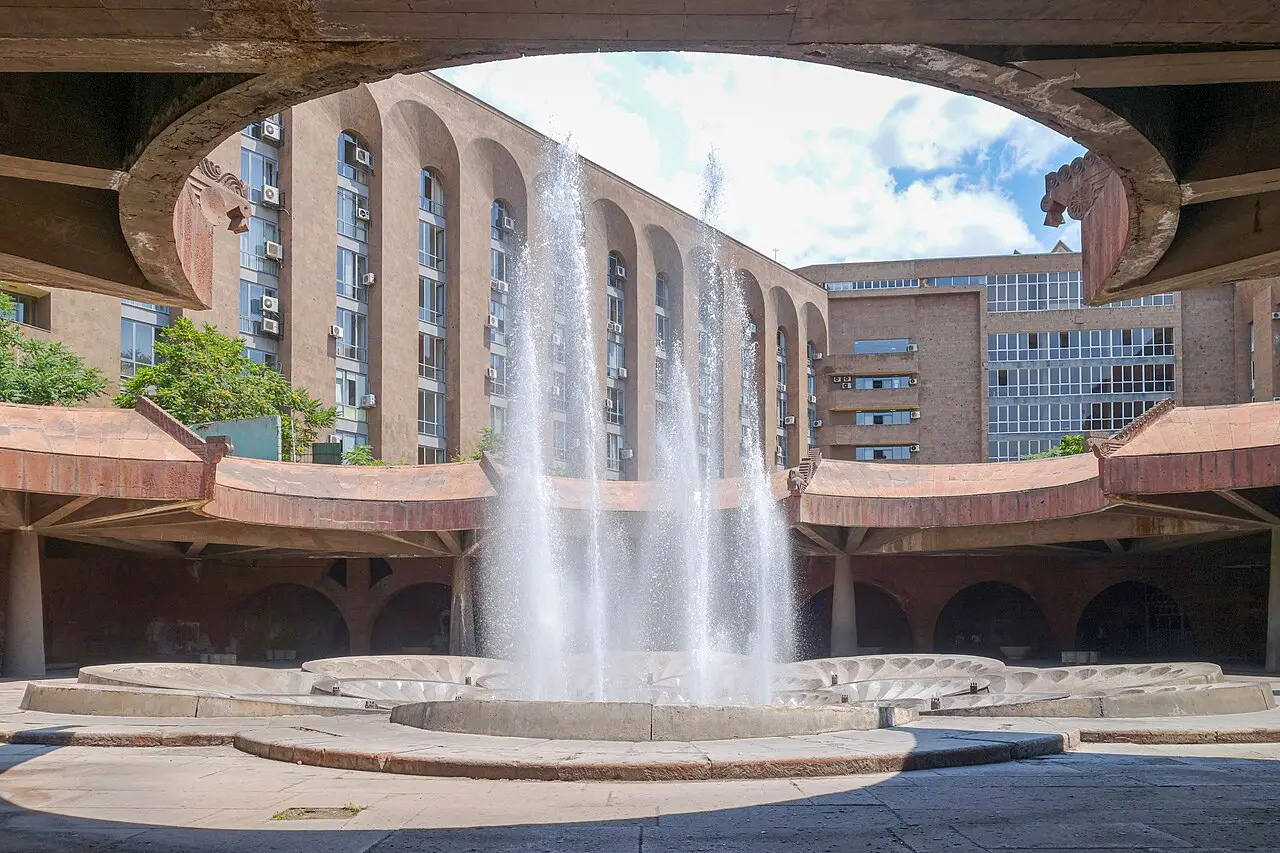
Yerevan
Route startstop ≈2880 min
Two unhurried days in the capital, with room for Echmiadzin and Zvartnots to the west that a shorter trip skips.
Photo: Armenak Margarian / Wikimedia Commons, CC BY-SA 4.0 - sourceUrl: https://commons.wikimedia.org/wiki/File:Republic_Square_Metro_Station_Fountains_in_Yerevan_2019-06-20v2.jpg -
Garni & Geghard
40 km from the startstop ≈300 min
A half-day east: the first-century Garni temple over its gorge, and the rock-cut Geghard monastery.
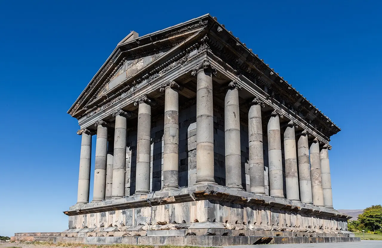
Photo: Diego Delso / Wikimedia Commons, CC BY-SA 4.0 - sourceUrl: https://commons.wikimedia.org/wiki/File:Templo_de_Garni,_Armenia,_2016-10-02,_DD_03.jpg -
Khor Virap
90 km from the startstop ≈150 min
The postcard monastery on the plain under Mount Ararat, best caught on a clear morning.
Photo: Marcin Konsek / Wikimedia Commons, CC BY-SA 4.0 - sourceUrl: https://commons.wikimedia.org/wiki/File:2014_Prowincja_Ararat,_Chor_Wirap_(05).jpg -
Areni
160 km from the startstop ≈120 min
The heart of Armenian wine country, and the Areni-1 cave with its 6,100-year-old winery.
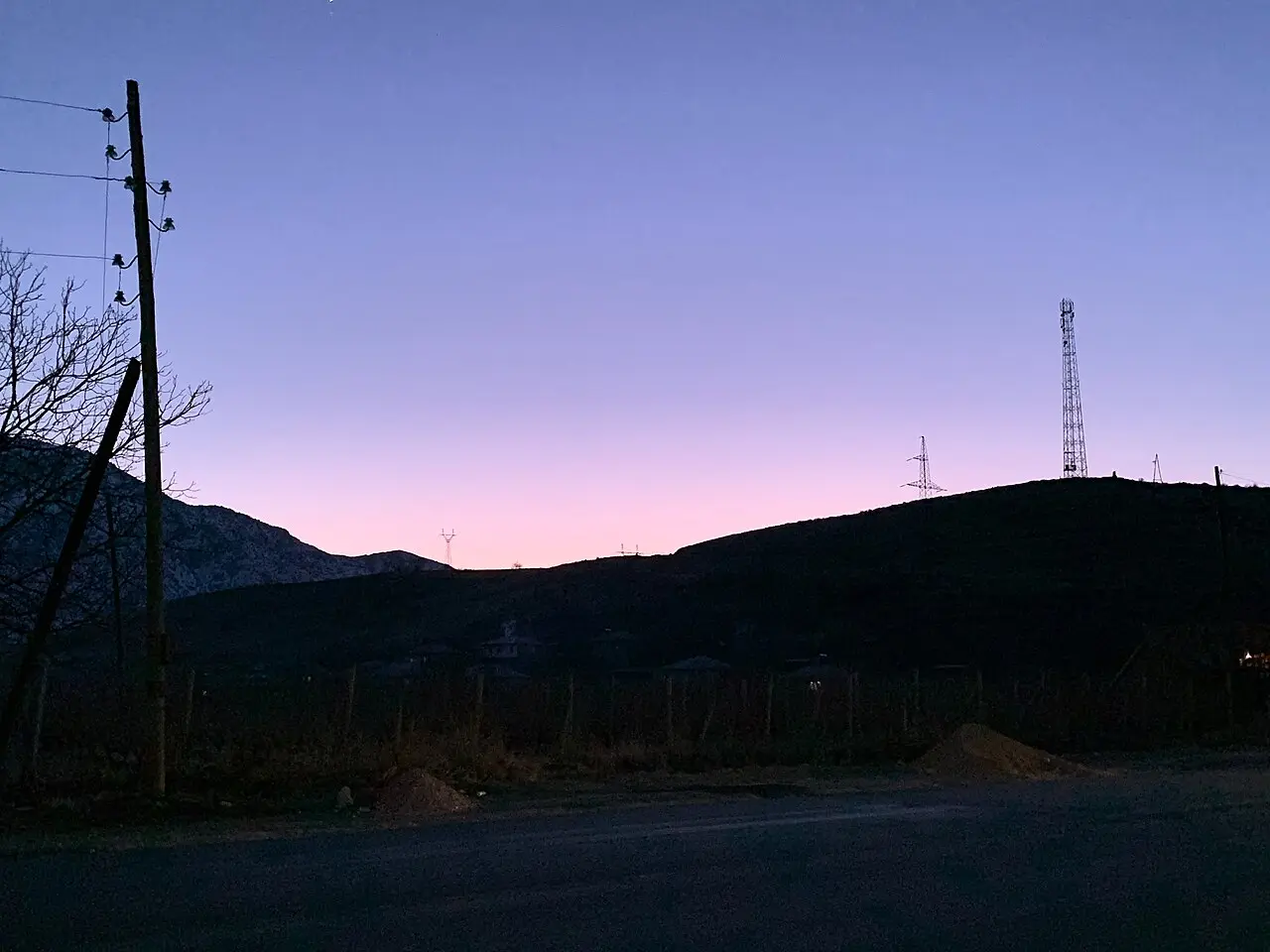
Photo: Robot8A / Wikimedia Commons, CC BY-SA 4.0 - sourceUrl: https://commons.wikimedia.org/wiki/File:Sunset_in_Areni.jpg -
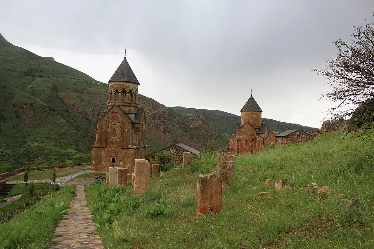
Noravank
175 km from the startstop ≈120 min
A honey-gold monastery wedged into a canyon of brick-red cliffs, with its famous cliff-face staircase.
Photo: Soghomon Matevosyan / Wikimedia Commons, CC BY-SA 4.0 - sourceUrl: https://commons.wikimedia.org/wiki/File:-%D5%86%D5%B8%D6%80%D5%A1%D5%BE%D5%A1%D5%B6%D6%84_%D5%BE%D5%A1%D5%B6%D5%A1%D5%AF%D5%A1%D5%B6_%D5%B0%D5%A1%D5%B4%D5%A1%D5%AC%D5%AB%D6%80.jpg -
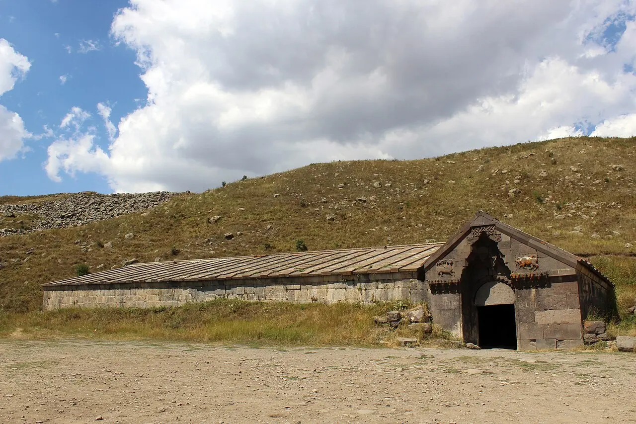
Selim Caravanserai
230 km from the startstop ≈90 min
A 1332 Silk Road caravanserai on the Vardenyats (Selim) Pass at 2,410 m, near the Yeghegis valley and Smbataberd. Pass closed in winter snow.
Photo: Soghomon Matevosyan / Wikimedia Commons, CC BY-SA 4.0 - sourceUrl: https://commons.wikimedia.org/wiki/File:-%D5%8D%D5%A5%D5%AC%D5%AB%D5%B4%D5%AB_%D6%84%D5%A1%D6%80%D5%A1%D5%BE%D5%A1%D5%B6%D5%A1%D5%BF%D5%B8%D6%82%D5%B6.jpg -
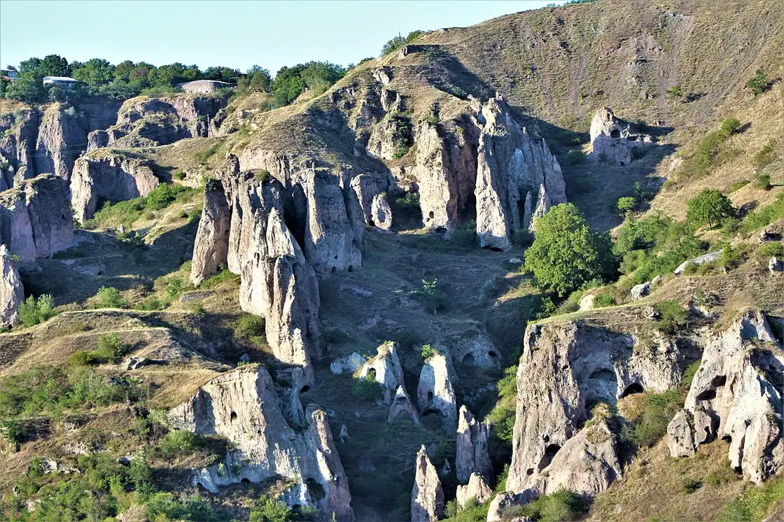
Goris
320 km from the startstop ≈720 min
The base town for the deep south, with the rock-hewn cave dwellings of Old Goris on the edge of the modern town.
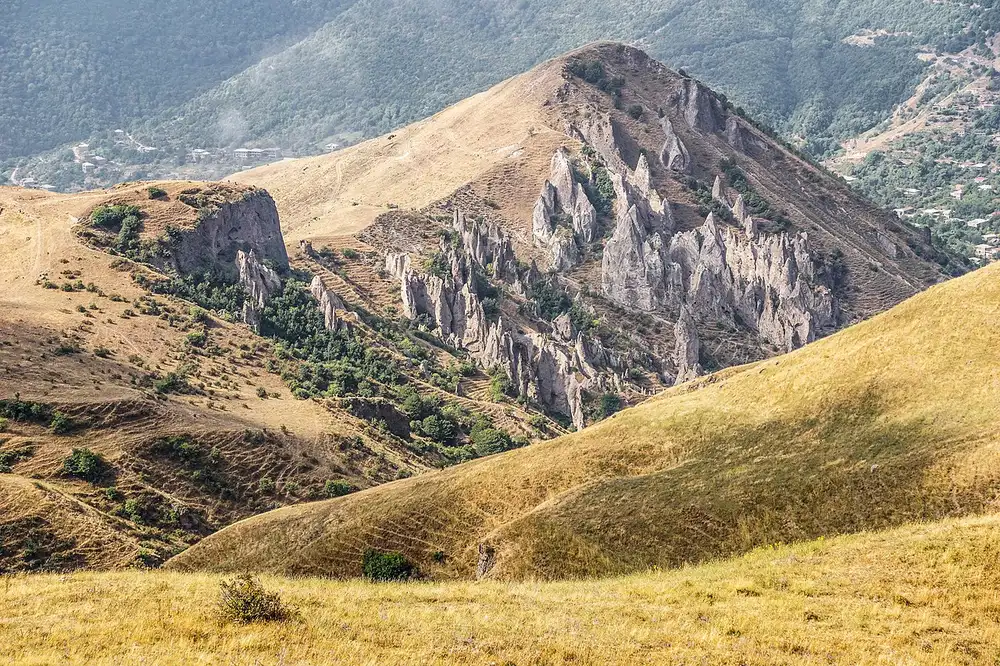
Photo: Matheus Hobold Sovernigo / Wikimedia Commons, CC BY-SA 4.0 - sourceUrl: https://commons.wikimedia.org/wiki/File:Goris_inhabited_rocks.jpg -
Tatev
355 km from the startstop ≈300 min
The Wings of Tatev cable car - 5,752 m, a world record - to the ninth-century Tatev monastery on its cliff.
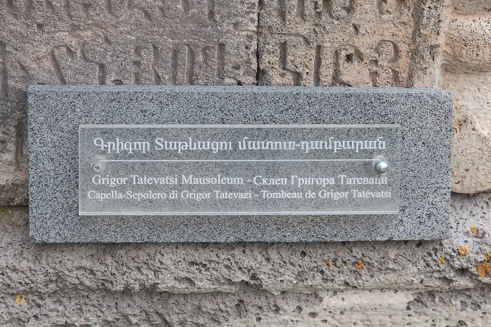
Photo: Marcin Konsek / Wikimedia Commons, CC BY-SA 4.0 - sourceUrl: https://commons.wikimedia.org/wiki/File:2014_Prowincja_Sjunik,_Klasztor_Tatew_(14).jpg -
Khndzoresk
360 km from the startstop ≈180 min
Old Khndzoresk, an abandoned cave village on a gorge, reached across a 160 m swinging footbridge inaugurated in 2012.
Photo: ՎԱՍ / Wikimedia Commons, CC BY-SA 4.0 - sourceUrl: https://commons.wikimedia.org/wiki/File:Khndzoresk,_%D5%8E%D4%B1%D5%8D_03.jpg -
Lake Sevan
560 km from the startstop ≈240 min
The great blue of the Caucasus at nearly 1,900 m, with the Sevanavank monastery on its peninsula. Time for a swim and lake trout.
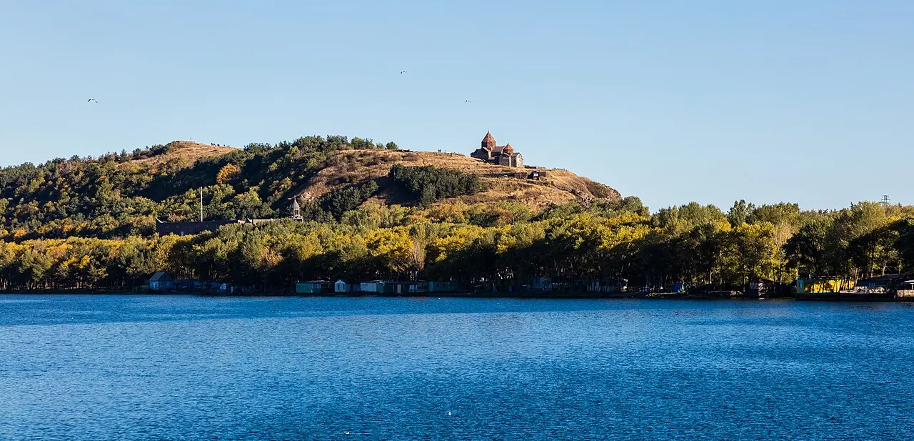
Photo: Diego Delso / Wikimedia Commons, CC BY-SA 4.0 - sourceUrl: https://commons.wikimedia.org/wiki/File:Monasterio_de_Sevanavank,_Armenia,_2016-10-02,_DD_99.jpg -
Dilijan
620 km from the startstop ≈600 min
The forested "Little Switzerland" - Haghartsin and Goshavank monasteries, a craft street and national-park trails, given a proper day.
Photo: Gaynane / Wikimedia Commons, CC BY-SA 4.0 - sourceUrl: https://commons.wikimedia.org/wiki/File:Haghartsin-1-30.10.17.jpg -
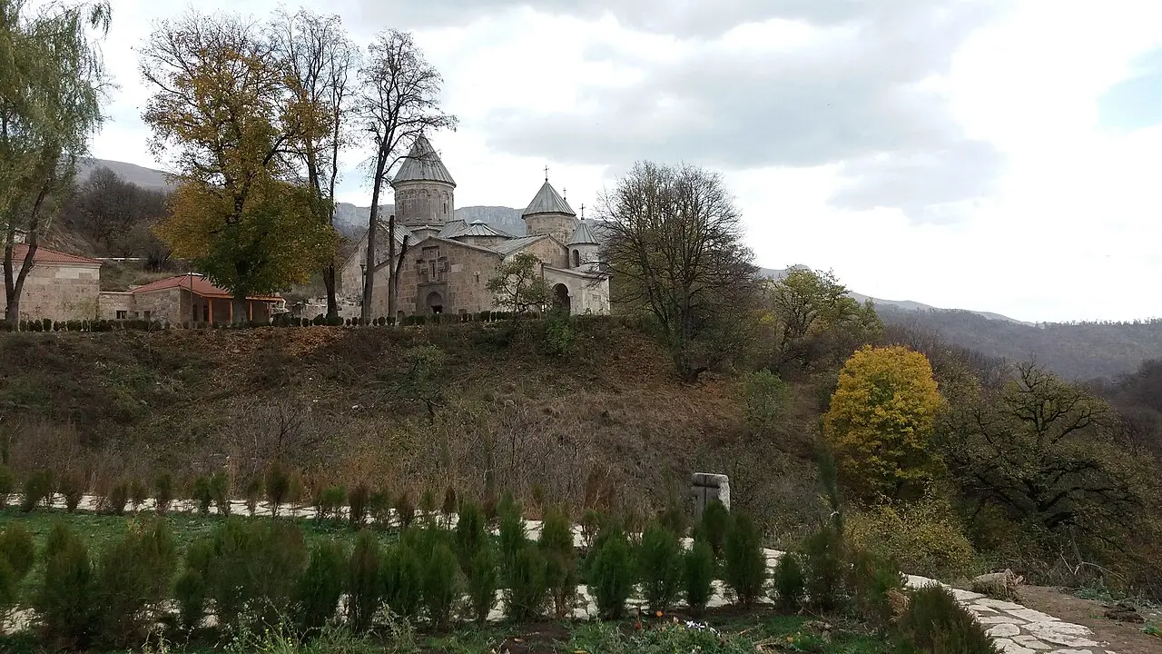
Haghpat & Sanahin
780 km from the startstop ≈240 min
Two UNESCO-listed medieval monasteries above the Debed canyon in the far north, the corridor toward Georgia.
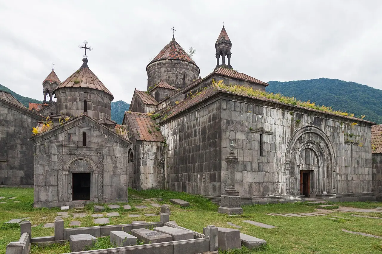
Photo: Marcin Konsek / Wikimedia Commons, CC BY-SA 4.0 - sourceUrl: https://commons.wikimedia.org/wiki/File:2014_Prowincja_Lorri,_Hachpat,_Klasztor_Hachpat_(12).jpg -
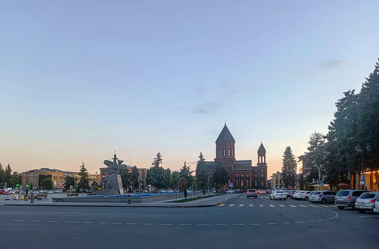
Gyumri
900 km from the startstop ≈480 min
Armenia's second city: the black-and-pink tuff Kumayri old district, galleries and craft, before the drive back to Yerevan.
Photo: Hayastan Mkrtchyan / Wikimedia Commons, CC BY-SA 4.0 - sourceUrl: https://commons.wikimedia.org/wiki/File:Church_of_the_Holy_Saviour_and_Vartanants_Square_2023-10-12.jpg
Route map
The map with stops loads on click - to keep the page lightweight.
The map didn’t load. Check your connection and refresh the page.